Tarnowo Podgórne geodata
Tarnowo Podgórne (Greater Poland) is a seat of a third-order administrative division; located in Poland in Europe/Warsaw (GMT+2) time zone. With population of 4,235 people, there are 774 cities with bigger population in this country. Compared to other cities in Poland, 75.9% of cities are located further ↓South; 88.4% of cities are located further →East and 81.2% of cities have higher elevation than Tarnowo Podgórne. Note1
Administrative division(s):
- Level 1: Greater Poland
- Level 2: Powiat poznański
- Level 3: Tarnowo Podgórne


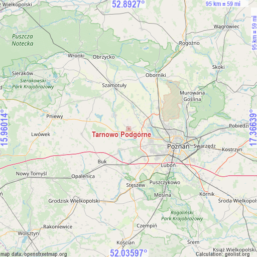
Tarnowo Podgórne GPS coordinates[2]
52° 27' 59.112" North, 16° 39' 47.736" East
| Map corner | latitude | longitude |
|---|---|---|
| Upper-left | 52.8927°, | 15.96014° |
| Center: | 52.46642°, | 16.66326° |
| Lower-right: | 52.03597°, | 17.36639° |
| Map W x H: | 95.3×95.3 km | = 59.2×59.2mi |
| max Lat: | 54.83135° ⇑24.1% North |
| Tarnowo Podgórne: | 52.46642° |
| min Lat: | ⇓75.9% South 49.21328° |
| min Long | Tarnowo Podgór | max Long |
| 14.20249° | 16.66326° | 24.03723° |
| W 11.6%⇐ | ⇒88.4% E |
Elevation
Elevation of Tarnowo Podgórne is 97 m = 318 ft, and this is 94.4 m = 310 ft below average elevation for this country.
| Max E: |
974 m = 3196 ft | 81.2% |
| Avg. | 191.4 m = 628 ft | |
| Tarnowo Podgórne | 97 m = 318 ft | |
Min E: |
-3 m = -10 ft | 18.8% |
See also: Poland elevation on elevation.city.
Geographical zone
Tarnowo Podgórne is located in North temperate zone (between Tropic of Cancer and the Arctic Circle). Distance of this North polar circle is 1567.5 km =974 mi to North.| Distance of | km | miles | from Tarnowo Podgórne |
|---|---|---|---|
| North Pole | 4173.3 | 2593.2 | to North |
| Arctic Circle | 1567.5 | 974 | to North |
| Tropic Cancer | 3227.8 | 2005.7 | to South |
| Equator | 5833.7 | 3624.9 | to South |


Nearby cities:
15 places around Tarnowo Podgórne: (largest is in red/bold)
• Baranowo
9 km =5.6 mi,  112°
112°
• Buk
15.7 km =9.8 mi,  218°
218°
• Dopiewo
12.2 km =7.6 mi,  176°
176°
• Duszniki
17.6 km =10.9 mi,  262°
262°
• Kaźmierz
7.5 km =4.7 mi,  314°
314°
• Komorniki
17.4 km =10.8 mi,  144°
144°
• Lipnica
17 km =10.6 mi, 313°
• Objezierze
16.8 km =10.4 mi,  23°
23°
• Pamiątkowo
9.7 km =6 mi,  7°
7°
• Plewiska
14.9 km =9.3 mi, 138°
• Rokietnica
7.6 km =4.7 mi,  47°
47°
• Suchy Las
14.5 km =9 mi,  87°
87°
• Szamotuły
17.2 km =10.7 mi,  340°
340°
• Zakrzewo
9.1 km =5.7 mi,  152°
152°
• Złotniki
12.7 km =7.9 mi,  75°
75°
Sources, notices
• [Note1] Compared only with cities in Poland existing in our database
• [Src1] Map data: © OpenStreetMap contributors (CC-BY-SA)
• [Src2] Other city data from geonames.org with taken over terms of usage.
• [Src3] Geographical zone / Annual Mean Temperature by Robert A. Rohde @ Wikipedia
