Starokrzepice geodata
Starokrzepice (Silesia) is a populated place; located in Poland in Europe/Warsaw (GMT+2) time zone. With population of 1,319 people, there are 2039 cities with bigger population in this country. Compared to other cities in Poland, 56.4% of cities are located further ↑North; 65.6% of cities are located further →East and 68.1% of cities have lower elevation than Starokrzepice. Note1


Starokrzepice GPS coordinates[2]
50° 56' 54.924" North, 18° 39' 12.276" East
| Map corner | latitude | longitude |
|---|---|---|
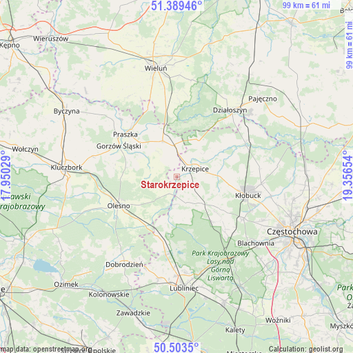
| Upper-left | 51.38946°, | 17.95029° |
| Center: | 50.94859°, | 18.65341° |
| Lower-right: | 50.5035°, | 19.35654° |
| Map W x H: | 98.5×98.5 km | = 61.2×61.2mi |
| max Lat: | 54.83135° ⇑56.4% North |
| Starokrzepice: | 50.94859° |
| min Lat: | ⇓43.6% South 49.21328° |
| min Long | Starokrzepice | max Long |
| 14.20249° | 18.65341° | 24.03723° |
| W 34.4%⇐ | ⇒65.6% E |
Elevation
Elevation of Starokrzepice is 223 m = 732 ft, and this is 31.6 m = 104 ft above average elevation for this country.
| Max E: |
974 m = 3196 ft | 31.9% |
| Starokrzepice | 223 m 732 ft | |
| Avg. | 191.4 m = 628 ft | |
Min E: |
-3 m = -10 ft | 68.1% |
See also: Poland elevation on elevation.city.
Geographical zone
Starokrzepice is located in North temperate zone (between Tropic of Cancer and the Arctic Circle). Distance of this North polar circle is 1736.2 km =1078.8 mi to North.| Distance of | km | miles | from Starokrzepice |
|---|---|---|---|
| North Pole | 4342.1 | 2698.1 | to North |
| Arctic Circle | 1736.2 | 1078.8 | to North |
| Tropic Cancer | 3059 | 1900.8 | to South |
| Equator | 5665 | 3520.1 | to South |


Nearby cities:
15 places around Starokrzepice: (largest is in red/bold)
• Dalachów
15.2 km =9.4 mi,  339°
339°
• Gorzów Śląski
18.4 km =11.4 mi,  298°
298°
• Kowale
19.2 km =11.9 mi,  319°
319°
• Krzepice
5.8 km =3.6 mi,  65°
65°
• Lipie
12.3 km =7.6 mi,  54°
54°
• Olesno
18.1 km =11.2 mi,  243°
243°
• Opatów
11.7 km =7.3 mi,  86°
86°
• Panki
10 km =6.2 mi,  136°
136°
• Praszka
18.2 km =11.3 mi,  309°
309°
• Przystajń
7.6 km =4.7 mi,  159°
159°
• Radłow
8.4 km =5.2 mi,  258°
258°
• Rudniki
10.7 km =6.6 mi, 338°
• Sieraków Śląski
17.1 km =10.6 mi,  198°
198°
• Truskolasy
15.2 km =9.4 mi,  126°
126°
• Wojciechów
19.2 km =11.9 mi,  252°
252°
Sources, notices
• [Note1] Compared only with cities in Poland existing in our database
• [Src1] Map data: © OpenStreetMap contributors (CC-BY-SA)
• [Src2] Other city data from geonames.org with taken over terms of usage.
• [Src3] Geographical zone / Annual Mean Temperature by Robert A. Rohde @ Wikipedia
