Przemęt geodata
Przemęt (Greater Poland) is a seat of a third-order administrative division; located in Poland in Europe/Warsaw (GMT+2) time zone. With population of 1,600 people, there are 1751 cities with bigger population in this country. Compared to other cities in Poland, 65.8% of cities are located further ↓South; 90.8% of cities are located further →East and 92.4% of cities have higher elevation than Przemęt. Note1


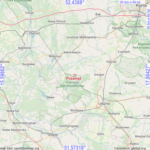
Przemęt GPS coordinates[2]
52° 0' 29.088" North, 16° 18' 4.104" East
| Map corner | latitude | longitude |
|---|---|---|
| Upper-left | 52.4388°, | 15.59802° |
| Center: | 52.00808°, | 16.30114° |
| Lower-right: | 51.57318°, | 17.00427° |
| Map W x H: | 96.2×96.2 km | = 59.8×59.8mi |
| max Lat: | 54.83135° ⇑34.2% North |
| Przemęt: | 52.00808° |
| min Lat: | ⇓65.8% South 49.21328° |
| min Long | Przemęt | max Long |
| 14.20249° | 16.30114° | 24.03723° |
| W 9.2%⇐ | ⇒90.8% E |
Elevation
Elevation of Przemęt is 63 m = 207 ft, and this is 128.4 m = 421 ft below average elevation for this country.
| Max E: |
974 m = 3196 ft | 92.4% |
| Avg. | 191.4 m = 628 ft | |
| Przemęt | 63 m = 207 ft | |
Min E: |
-3 m = -10 ft | 7.6% |
See also: Poland elevation on elevation.city.
Geographical zone
Przemęt is located in North temperate zone (between Tropic of Cancer and the Arctic Circle). Distance of this North polar circle is 1618.4 km =1005.6 mi to North.| Distance of | km | miles | from Przemęt |
|---|---|---|---|
| North Pole | 4224.3 | 2624.9 | to North |
| Arctic Circle | 1618.4 | 1005.6 | to North |
| Tropic Cancer | 3176.8 | 1974 | to South |
| Equator | 5782.8 | 3593.3 | to South |


Nearby cities:
15 places around Przemęt: (largest is in red/bold)
• Bojanowo Stare
19.4 km =12.1 mi,  94°
94°
• Brenno
11.2 km =7 mi,  211°
211°
• Jabłonna
22.9 km =14.2 mi,  343°
343°
• Kamieniec
20.7 km =12.9 mi,  31°
31°
• Lipno
20.8 km =12.9 mi,  119°
119°
• Rakoniewice
14.7 km =9.1 mi,  352°
352°
• Sława
21.5 km =13.4 mi,  226°
226°
• Wielichowo
12.5 km =7.8 mi,  16°
16°
• Wijewo
12.9 km =8 mi,  217°
217°
• Wilkowice
21 km =13 mi,  130°
130°
• Wolsztyn
17.3 km =10.7 mi,  313°
313°
• Wschowa
22.4 km =13.9 mi,  177°
177°
• Włoszakowice
10 km =6.2 mi,  154°
154°
• Śmigiel
15.5 km =9.6 mi, 87°
• Święciechowa
21.7 km =13.5 mi,  141°
141°
Sources, notices
• [Note1] Compared only with cities in Poland existing in our database
• [Src1] Map data: © OpenStreetMap contributors (CC-BY-SA)
• [Src2] Other city data from geonames.org with taken over terms of usage.
• [Src3] Geographical zone / Annual Mean Temperature by Robert A. Rohde @ Wikipedia
