Krzyż Wielkopolski geodata
Krzyż Wielkopolski (Greater Poland) is a seat of a third-order administrative division; located in Poland in Europe/Warsaw (GMT+2) time zone. With population of 6,300 people, there are 580 cities with bigger population in this country. Compared to other cities in Poland, 82% of cities are located further ↓South; 92.5% of cities are located further →East and 96% of cities have higher elevation than Krzyż Wielkopolski. Note1
Administrative division(s):
- Level 1: Greater Poland
- Level 2: Powiat czarnkowsko-trzcianecki
- Level 3: Krzyż Wielkopolski


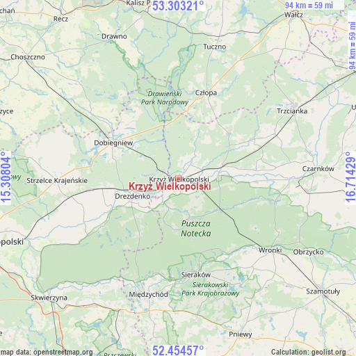
Krzyż Wielkopolski GPS coordinates[2]
52° 52' 51.492" North, 16° 0' 40.176" East
| Map corner | latitude | longitude |
|---|---|---|
| Upper-left | 53.30321°, | 15.30804° |
| Center: | 52.88097°, | 16.01116° |
| Lower-right: | 52.45457°, | 16.71429° |
| Map W x H: | 94.4×94.4 km | = 58.7×58.7mi |
| max Lat: | 54.83135° ⇑18% North |
| Krzyż Wielkopolski: | 52.88097° |
| min Lat: | ⇓82% South 49.21328° |
| min Long | Krzyż Wielkopo | max Long |
| 14.20249° | 16.01116° | 24.03723° |
| W 7.5%⇐ | ⇒92.5% E |
Elevation
Elevation of Krzyż Wielkopolski is 32 m = 105 ft, and this is 159.4 m = 523 ft below average elevation for this country.
| Max E: |
974 m = 3196 ft | 96% |
| Avg. | 191.4 m = 628 ft | |
| Krzyż Wielkopolski | 32 m = 105 ft | |
Min E: |
-3 m = -10 ft | 4% |
See also: Poland elevation on elevation.city.
Geographical zone
Krzyż Wielkopolski is located in North temperate zone (between Tropic of Cancer and the Arctic Circle). Distance of this North polar circle is 1521.4 km =945.4 mi to North.| Distance of | km | miles | from Krzyż Wielkopolski |
|---|---|---|---|
| North Pole | 4127.2 | 2564.5 | to North |
| Arctic Circle | 1521.4 | 945.4 | to North |
| Tropic Cancer | 3273.9 | 2034.3 | to South |
| Equator | 5879.8 | 3653.5 | to South |


Nearby cities:
15 places around Krzyż Wielkopolski: (largest is in red/bold)
• Bierzwnik
28.9 km =18 mi,  306°
306°
• Chrzypsko Wielkie
31.7 km =19.7 mi,  152°
152°
• Człopa
24.2 km =15 mi,  17°
17°
• Dobiegniew
19.9 km =12.4 mi,  299°
299°
• Drawsko
3.3 km =2.1 mi,  155°
155°
• Drezdenko
13 km =8.1 mi,  248°
248°
• Lutom
29.7 km =18.5 mi, 162°
• Międzychód
32.3 km =20.1 mi,  193°
193°
• Siedlisko
27.7 km =17.2 mi,  64°
64°
• Sieraków
26 km =16.2 mi,  169°
169°
• Stare Kurowo
22.6 km =14 mi,  263°
263°
• Strzelce Krajeńskie
32.3 km =20.1 mi,  269°
269°
• Wieleń
10.9 km =6.8 mi,  81°
81°
• Wronki
31.2 km =19.4 mi,  127°
127°
• Zwierzyń
30.3 km =18.8 mi, 259°
Sources, notices
• [Note1] Compared only with cities in Poland existing in our database
• [Src1] Map data: © OpenStreetMap contributors (CC-BY-SA)
• [Src2] Other city data from geonames.org with taken over terms of usage.
• [Src3] Geographical zone / Annual Mean Temperature by Robert A. Rohde @ Wikipedia
