Korytnica geodata
Korytnica (Mazovia) is a seat of a third-order administrative division; located in Poland in Europe/Warsaw (GMT+2) time zone. With population of 747 people, there are 2976 cities with bigger population in this country. Compared to other cities in Poland, 75% of cities are located further ↓South; 82.8% of cities are located further ←West and 63.4% of cities have higher elevation than Korytnica. Note1


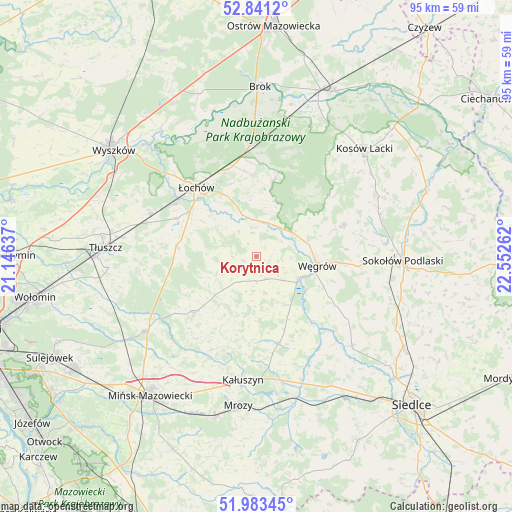
Korytnica GPS coordinates[2]
52° 24' 51.876" North, 21° 50' 58.164" East
| Map corner | latitude | longitude |
|---|---|---|
| Upper-left | 52.8412°, | 21.14637° |
| Center: | 52.41441°, | 21.84949° |
| Lower-right: | 51.98345°, | 22.55262° |
| Map W x H: | 95.4×95.4 km | = 59.3×59.3mi |
| max Lat: | 54.83135° ⇑25% North |
| Korytnica: | 52.41441° |
| min Lat: | ⇓75% South 49.21328° |
| min Long | Korytnica | max Long |
| 14.20249° | 21.84949° | 24.03723° |
| W 82.8%⇐ | ⇒17.2% E |
Elevation
Elevation of Korytnica is 138 m = 453 ft, and this is 53.4 m = 175 ft below average elevation for this country.
| Max E: |
974 m = 3196 ft | 63.4% |
| Avg. | 191.4 m = 628 ft | |
| Korytnica | 138 m = 453 ft | |
Min E: |
-3 m = -10 ft | 36.6% |
See also: Poland elevation on elevation.city.
Geographical zone
Korytnica is located in North temperate zone (between Tropic of Cancer and the Arctic Circle). Distance of this North polar circle is 1573.2 km =977.5 mi to North.| Distance of | km | miles | from Korytnica |
|---|---|---|---|
| North Pole | 4179.1 | 2596.8 | to North |
| Arctic Circle | 1573.2 | 977.5 | to North |
| Tropic Cancer | 3222 | 2002.1 | to South |
| Equator | 5827.9 | 3621.3 | to South |


Nearby cities:
15 places around Korytnica: (largest is in red/bold)
• Dobre
15.6 km =9.7 mi,  228°
228°
• Grębków
16.6 km =10.3 mi,  165°
165°
• Jadów
16.4 km =10.2 mi,  295°
295°
• Jakubów
24.5 km =15.2 mi,  207°
207°
• Kałuszyn
23.3 km =14.5 mi,  186°
186°
• Liw
9.1 km =5.7 mi,  118°
118°
• Miedzna
17.3 km =10.7 mi,  69°
69°
• Mokobody
24.3 km =15.1 mi,  132°
132°
• Ostrówek
16.6 km =10.3 mi,  338°
338°
• Stoczek
14.7 km =9.1 mi,  13°
13°
• Strachówka
14.6 km =9.1 mi,  275°
275°
• Wierzbno
11.6 km =7.2 mi,  176°
176°
• Wiśniew
19.3 km =12 mi, 206°
• Węgrów
11.4 km =7.1 mi,  98°
98°
• Łochów
17.2 km =10.7 mi,  318°
318°
Sources, notices
• [Note1] Compared only with cities in Poland existing in our database
• [Src1] Map data: © OpenStreetMap contributors (CC-BY-SA)
• [Src2] Other city data from geonames.org with taken over terms of usage.
• [Src3] Geographical zone / Annual Mean Temperature by Robert A. Rohde @ Wikipedia
