Wierzbno geodata
Wierzbno (Mazovia) is a seat of a third-order administrative division; located in Poland in Europe/Warsaw (GMT+2) time zone. With population of 358 people, there are 3605 cities with bigger population in this country. Compared to other cities in Poland, 72.7% of cities are located further ↓South; 82.9% of cities are located further ←West and 57.8% of cities have higher elevation than Wierzbno. Note1


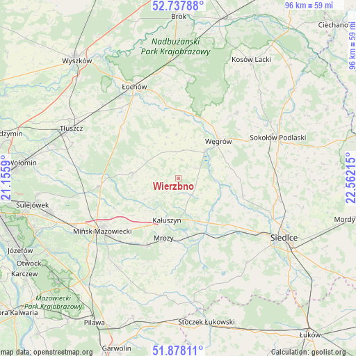
Wierzbno GPS coordinates[2]
52° 18' 36.288" North, 21° 51' 32.472" East
| Map corner | latitude | longitude |
|---|---|---|
| Upper-left | 52.73788°, | 21.1559° |
| Center: | 52.31008°, | 21.85902° |
| Lower-right: | 51.87811°, | 22.56215° |
| Map W x H: | 95.6×95.6 km | = 59.4×59.4mi |
| max Lat: | 54.83135° ⇑27.3% North |
| Wierzbno: | 52.31008° |
| min Lat: | ⇓72.7% South 49.21328° |
| min Long | Wierzbno | max Long |
| 14.20249° | 21.85902° | 24.03723° |
| W 82.9%⇐ | ⇒17.1% E |
Elevation
Elevation of Wierzbno is 151 m = 495 ft, and this is 40.4 m = 133 ft below average elevation for this country.
| Max E: |
974 m = 3196 ft | 57.8% |
| Avg. | 191.4 m = 628 ft | |
| Wierzbno | 151 m = 495 ft | |
Min E: |
-3 m = -10 ft | 42.2% |
See also: Poland elevation on elevation.city.
Geographical zone
Wierzbno is located in North temperate zone (between Tropic of Cancer and the Arctic Circle). Distance of this North polar circle is 1584.8 km =984.7 mi to North.| Distance of | km | miles | from Wierzbno |
|---|---|---|---|
| North Pole | 4190.7 | 2604 | to North |
| Arctic Circle | 1584.8 | 984.7 | to North |
| Tropic Cancer | 3210.4 | 1994.8 | to South |
| Equator | 5816.3 | 3614.1 | to South |


Nearby cities:
15 places around Wierzbno: (largest is in red/bold)
• Cegłów
19.9 km =12.4 mi,  204°
204°
• Dobre
12.3 km =7.6 mi,  275°
275°
• Grębków
5.7 km =3.5 mi,  142°
142°
• Jakubów
15.8 km =9.8 mi,  230°
230°
• Kałuszyn
12 km =7.5 mi, 196°
• Korytnica
11.6 km =7.2 mi,  356°
356°
• Kotuń
20.6 km =12.8 mi, 136°
• Liw
10.3 km =6.4 mi,  45°
45°
• Miedzna
23.5 km =14.6 mi,  41°
41°
• Mokobody
17.9 km =11.1 mi,  106°
106°
• Mrozy
16.5 km =10.3 mi,  193°
193°
• Stanisławów
21.2 km =13.2 mi,  263°
263°
• Strachówka
20 km =12.4 mi,  310°
310°
• Wiśniew
10.8 km =6.7 mi,  237°
237°
• Węgrów
14.6 km =9.1 mi, 47°
Sources, notices
• [Note1] Compared only with cities in Poland existing in our database
• [Src1] Map data: © OpenStreetMap contributors (CC-BY-SA)
• [Src2] Other city data from geonames.org with taken over terms of usage.
• [Src3] Geographical zone / Annual Mean Temperature by Robert A. Rohde @ Wikipedia
