Grębków geodata
Grębków (Mazovia) is a seat of a third-order administrative division; located in Poland in Europe/Warsaw (GMT+2) time zone. With population of 345 people, there are 3609 cities with bigger population in this country. Compared to other cities in Poland, 72% of cities are located further ↓South; 83.6% of cities are located further ←West and 60.6% of cities have higher elevation than Grębków. Note1


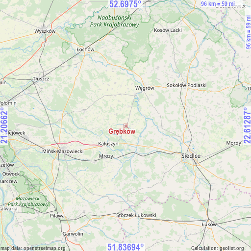
Grębków GPS coordinates[2]
52° 16' 9.516" North, 21° 54' 35.064" East
| Map corner | latitude | longitude |
|---|---|---|
| Upper-left | 52.6975°, | 21.20662° |
| Center: | 52.26931°, | 21.90974° |
| Lower-right: | 51.83694°, | 22.61287° |
| Map W x H: | 95.7×95.7 km | = 59.5×59.5mi |
| max Lat: | 54.83135° ⇑28% North |
| Grębków: | 52.26931° |
| min Lat: | ⇓72% South 49.21328° |
| min Long | Grębków | max Long |
| 14.20249° | 21.90974° | 24.03723° |
| W 83.6%⇐ | ⇒16.4% E |
Elevation
Elevation of Grębków is 145 m = 476 ft, and this is 46.4 m = 152 ft below average elevation for this country.
| Max E: |
974 m = 3196 ft | 60.6% |
| Avg. | 191.4 m = 628 ft | |
| Grębków | 145 m = 476 ft | |
Min E: |
-3 m = -10 ft | 39.4% |
See also: Poland elevation on elevation.city.
Geographical zone
Grębków is located in North temperate zone (between Tropic of Cancer and the Arctic Circle). Distance of this North polar circle is 1589.4 km =987.6 mi to North.| Distance of | km | miles | from Grębków |
|---|---|---|---|
| North Pole | 4195.3 | 2606.8 | to North |
| Arctic Circle | 1589.4 | 987.6 | to North |
| Tropic Cancer | 3205.9 | 1992.1 | to South |
| Equator | 5811.8 | 3611.3 | to South |


Nearby cities:
15 places around Grębków: (largest is in red/bold)
• Bielany
24.4 km =15.2 mi,  70°
70°
• Cegłów
17.9 km =11.1 mi,  221°
221°
• Dobre
16.7 km =10.4 mi,  290°
290°
• Jakubów
16.6 km =10.3 mi,  250°
250°
• Kałuszyn
9.8 km =6.1 mi, 224°
• Korytnica
16.6 km =10.3 mi,  345°
345°
• Kotuń
14.9 km =9.3 mi,  133°
133°
• Liw
12.4 km =7.7 mi,  18°
18°
• Mokobody
13.8 km =8.6 mi,  91°
91°
• Mrozy
13.6 km =8.5 mi,  212°
212°
• Skórzec
23.5 km =14.6 mi,  140°
140°
• Suchożebry
23.4 km =14.5 mi, 92°
• Wierzbno
5.7 km =3.5 mi,  322°
322°
• Wiśniew
12.7 km =7.9 mi,  264°
264°
• Węgrów
16.2 km =10.1 mi,  26°
26°
Sources, notices
• [Note1] Compared only with cities in Poland existing in our database
• [Src1] Map data: © OpenStreetMap contributors (CC-BY-SA)
• [Src2] Other city data from geonames.org with taken over terms of usage.
• [Src3] Geographical zone / Annual Mean Temperature by Robert A. Rohde @ Wikipedia
