Strzyżowice geodata
Strzyżowice (Lublin) is a seat of a third-order administrative division; located in Poland in Europe/Warsaw (GMT+2) time zone. With population of 648 people, there are 3173 cities with bigger population in this country. Compared to other cities in Poland, 54% of cities are located further ↑North; 90.9% of cities are located further ←West and 59.4% of cities have lower elevation than Strzyżowice. Note1


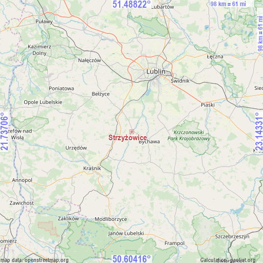
Strzyżowice GPS coordinates[2]
51° 2' 53.88" North, 22° 26' 24.648" East
| Map corner | latitude | longitude |
|---|---|---|
| Upper-left | 51.48822°, | 21.73706° |
| Center: | 51.0483°, | 22.44018° |
| Lower-right: | 50.60416°, | 23.14331° |
| Map W x H: | 98.3×98.3 km | = 61.1×61.1mi |
| max Lat: | 54.83135° ⇑54% North |
| Strzyżowice: | 51.0483° |
| min Lat: | ⇓46% South 49.21328° |
| min Long | Strzyżowice | max Long |
| 14.20249° | 22.44018° | 24.03723° |
| W 90.9%⇐ | ⇒9.1% E |
Elevation
Elevation of Strzyżowice is 199 m = 653 ft, and this is 7.6 m = 25 ft above average elevation for this country.
| Max E: |
974 m = 3196 ft | 40.6% |
| Strzyżowice | 199 m 653 ft | |
| Avg. | 191.4 m = 628 ft | |
Min E: |
-3 m = -10 ft | 59.4% |
See also: Poland elevation on elevation.city.
Geographical zone
Strzyżowice is located in North temperate zone (between Tropic of Cancer and the Arctic Circle). Distance of this North polar circle is 1725.1 km =1071.9 mi to North.| Distance of | km | miles | from Strzyżowice |
|---|---|---|---|
| North Pole | 4331 | 2691.2 | to North |
| Arctic Circle | 1725.1 | 1071.9 | to North |
| Tropic Cancer | 3070.1 | 1907.7 | to South |
| Equator | 5676 | 3526.9 | to South |


Nearby cities:
15 places around Strzyżowice: (largest is in red/bold)
• Bełżyce
17.9 km =11.1 mi,  321°
321°
• Borzechów
12 km =7.5 mi,  294°
294°
• Bychawa
7.4 km =4.6 mi,  118°
118°
• Bystrzyca
6.9 km =4.3 mi,  198°
198°
• Jabłonna
11.6 km =7.2 mi,  67°
67°
• Konopnica
20.1 km =12.5 mi,  4°
4°
• Kozubszczyzna
19.5 km =12.1 mi,  357°
357°
• Kraśnik
20.4 km =12.7 mi,  227°
227°
• Krzczonów
19.5 km =12.1 mi,  103°
103°
• Niedrzwica Duża
8.2 km =5.1 mi,  334°
334°
• Rudnik Pierwszy
9.6 km =6 mi,  180°
180°
• Sułów
16.7 km =10.4 mi, 199°
• Wilkołaz
7.3 km =4.5 mi,  239°
239°
• Zakrzówek
11.5 km =7.1 mi, 200°
• Żabia Wola
9.5 km =5.9 mi,  33°
33°
Sources, notices
• [Note1] Compared only with cities in Poland existing in our database
• [Src1] Map data: © OpenStreetMap contributors (CC-BY-SA)
• [Src2] Other city data from geonames.org with taken over terms of usage.
• [Src3] Geographical zone / Annual Mean Temperature by Robert A. Rohde @ Wikipedia
