Stawiguda geodata
Stawiguda (Warmia-Masuria) is a populated place; located in Poland in Europe/Warsaw (GMT+2) time zone. With population of 1,464 people, there are 1904 cities with bigger population in this country. Compared to other cities in Poland, 91.1% of cities are located further ↓South; 63.8% of cities are located further ←West and 59.5% of cities have higher elevation than Stawiguda. Note1


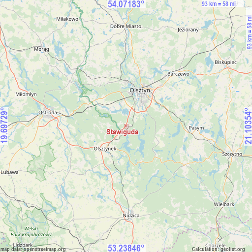
Stawiguda GPS coordinates[2]
53° 39' 25.92" North, 20° 24' 1.476" East
| Map corner | latitude | longitude |
|---|---|---|
| Upper-left | 54.07183°, | 19.69729° |
| Center: | 53.6572°, | 20.40041° |
| Lower-right: | 53.23846°, | 21.10354° |
| Map W x H: | 92.7×92.7 km | = 57.6×57.6mi |
| max Lat: | 54.83135° ⇑8.9% North |
| Stawiguda: | 53.6572° |
| min Lat: | ⇓91.1% South 49.21328° |
| min Long | Stawiguda | max Long |
| 14.20249° | 20.40041° | 24.03723° |
| W 63.8%⇐ | ⇒36.2% E |
Elevation
Elevation of Stawiguda is 148 m = 486 ft, and this is 43.4 m = 142 ft below average elevation for this country.
| Max E: |
974 m = 3196 ft | 59.5% |
| Avg. | 191.4 m = 628 ft | |
| Stawiguda | 148 m = 486 ft | |
Min E: |
-3 m = -10 ft | 40.5% |
See also: Poland elevation on elevation.city.
Geographical zone
Stawiguda is located in North temperate zone (between Tropic of Cancer and the Arctic Circle). Distance of this North polar circle is 1435.1 km =891.7 mi to North.| Distance of | km | miles | from Stawiguda |
|---|---|---|---|
| North Pole | 4040.9 | 2510.9 | to North |
| Arctic Circle | 1435.1 | 891.7 | to North |
| Tropic Cancer | 3360.2 | 2087.9 | to South |
| Equator | 5966.1 | 3707.2 | to South |


Nearby cities:
15 places around Stawiguda: (largest is in red/bold)
• Barczewo
27.1 km =16.8 mi,  44°
44°
• Dywity
20.7 km =12.9 mi,  14°
14°
• Gierzwałd
24.3 km =15.1 mi,  237°
237°
• Gietrzwałd
14.6 km =9.1 mi,  312°
312°
• Jabłonka
20.6 km =12.8 mi,  149°
149°
• Jedwabno
25.8 km =16 mi,  123°
123°
• Jonkowo
19.9 km =12.4 mi,  342°
342°
• Kortowo
11.7 km =7.3 mi,  18°
18°
• Mielno
21 km =13 mi,  220°
220°
• Olsztyn
15 km =9.3 mi, 24°
• Olsztynek
11.2 km =7 mi, 223°
• Pasym
25.8 km =16 mi,  91°
91°
• Purda
21 km =13 mi,  74°
74°
• Spręcowo
24.9 km =15.5 mi, 5°
• Łukta
26.5 km =16.5 mi, 308°
Sources, notices
• [Note1] Compared only with cities in Poland existing in our database
• [Src1] Map data: © OpenStreetMap contributors (CC-BY-SA)
• [Src2] Other city data from geonames.org with taken over terms of usage.
• [Src3] Geographical zone / Annual Mean Temperature by Robert A. Rohde @ Wikipedia
