Dywity geodata
Dywity (Warmia-Masuria) is a populated place; located in Poland in Europe/Warsaw (GMT+2) time zone. With population of 2,300 people, there are 1321 cities with bigger population in this country. Compared to other cities in Poland, 92.6% of cities are located further ↓South; 64.8% of cities are located further ←West and 65.2% of cities have higher elevation than Dywity. Note1
Administrative division(s):
- Level 1: Warmia-Masuria
- Level 2: Powiat olsztyński
- Level 3: Gmina Dywity


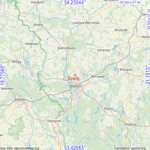
Dywity GPS coordinates[2]
53° 50' 15.324" North, 20° 28' 41.412" East
| Map corner | latitude | longitude |
|---|---|---|
| Upper-left | 54.25044°, | 19.77505° |
| Center: | 53.83759°, | 20.47817° |
| Lower-right: | 53.42063°, | 21.1813° |
| Map W x H: | 92.3×92.3 km | = 57.4×57.4mi |
| max Lat: | 54.83135° ⇑7.4% North |
| Dywity: | 53.83759° |
| min Lat: | ⇓92.6% South 49.21328° |
| min Long | Dywity | max Long |
| 14.20249° | 20.47817° | 24.03723° |
| W 64.8%⇐ | ⇒35.2% E |
Elevation
Elevation of Dywity is 132 m = 433 ft, and this is 59.4 m = 195 ft below average elevation for this country.
| Max E: |
974 m = 3196 ft | 65.2% |
| Avg. | 191.4 m = 628 ft | |
| Dywity | 132 m = 433 ft | |
Min E: |
-3 m = -10 ft | 34.8% |
See also: Poland elevation on elevation.city.
Geographical zone
Dywity is located in North temperate zone (between Tropic of Cancer and the Arctic Circle). Distance of this North polar circle is 1415 km =879.2 mi to North.| Distance of | km | miles | from Dywity |
|---|---|---|---|
| North Pole | 4020.9 | 2498.5 | to North |
| Arctic Circle | 1415 | 879.2 | to North |
| Tropic Cancer | 3380.3 | 2100.4 | to South |
| Equator | 5986.2 | 3719.7 | to South |


Nearby cities:
15 places around Dywity: (largest is in red/bold)
• Barczewo
14 km =8.7 mi,  93°
93°
• Czerwonka
28.8 km =17.9 mi,  72°
72°
• Dobre Miasto
17.4 km =10.8 mi,  342°
342°
• Gietrzwałd
18.8 km =11.7 mi,  237°
237°
• Jeziorany
23.3 km =14.5 mi,  48°
48°
• Jonkowo
11 km =6.8 mi,  264°
264°
• Kortowo
9 km =5.6 mi,  189°
189°
• Lubomino
29.9 km =18.6 mi,  328°
328°
• Olsztyn
6.5 km =4 mi,  170°
170°
• Pasym
29.3 km =18.2 mi,  135°
135°
• Purda
20.8 km =12.9 mi,  133°
133°
• Spręcowo
5.4 km =3.4 mi, 330°
• Stawiguda
20.7 km =12.9 mi, 194°
• Łukta
26.1 km =16.2 mi, 262°
• Świątki
18.4 km =11.4 mi,  302°
302°
Sources, notices
• [Note1] Compared only with cities in Poland existing in our database
• [Src1] Map data: © OpenStreetMap contributors (CC-BY-SA)
• [Src2] Other city data from geonames.org with taken over terms of usage.
• [Src3] Geographical zone / Annual Mean Temperature by Robert A. Rohde @ Wikipedia
