Krempna geodata
Krempna (Subcarpathian) is a seat of a third-order administrative division; located in Poland in Europe/Warsaw (GMT+2) time zone. With population of 500 people, there are 3540 cities with bigger population in this country. Compared to other cities in Poland, 98.1% of cities are located further ↑North; 79.2% of cities are located further ←West and 93.1% of cities have lower elevation than Krempna. Note1


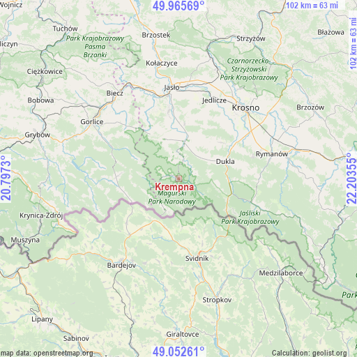
Krempna GPS coordinates[2]
49° 30' 40.608" North, 21° 30' 1.512" East
| Map corner | latitude | longitude |
|---|---|---|
| Upper-left | 49.96569°, | 20.7973° |
| Center: | 49.51128°, | 21.50042° |
| Lower-right: | 49.05261°, | 22.20355° |
| Map W x H: | 101.5×101.5 km | = 63.1×63.1mi |
| max Lat: | 54.83135° ⇑98.1% North |
| Krempna: | 49.51128° |
| min Lat: | ⇓1.9% South 49.21328° |
| min Long | Krempna | max Long |
| 14.20249° | 21.50042° | 24.03723° |
| W 79.2%⇐ | ⇒20.8% E |
Elevation
Elevation of Krempna is 371 m = 1217 ft, and this is 179.6 m = 589 ft above average elevation for this country.
| Max E: |
974 m = 3196 ft | 6.9% |
| Krempna | 371 m 1217 ft | |
| Avg. | 191.4 m = 628 ft | |
Min E: |
-3 m = -10 ft | 93.1% |
See also: Poland elevation on elevation.city.
Geographical zone
Krempna is located in North temperate zone (between Tropic of Cancer and the Arctic Circle). Distance of this North polar circle is 1896 km =1178.1 mi to North.| Distance of | km | miles | from Krempna |
|---|---|---|---|
| North Pole | 4501.9 | 2797.4 | to North |
| Arctic Circle | 1896 | 1178.1 | to North |
| Tropic Cancer | 2899.2 | 1801.5 | to South |
| Equator | 5505.1 | 3420.7 | to South |


Nearby cities:
15 places around Krempna: (largest is in red/bold)
• Chorkówka
19.5 km =12.1 mi,  39°
39°
• Dukla
14.1 km =8.8 mi,  69°
69°
• Dębowiec
19.4 km =12.1 mi,  351°
351°
• Iwonicz-Zdrój
21.7 km =13.5 mi, 74°
• Jasło
26.1 km =16.2 mi,  355°
355°
• Jaśliska
23.5 km =14.6 mi,  109°
109°
• Jedlicze
25.3 km =15.7 mi,  25°
25°
• Lipinki
23.4 km =14.5 mi,  320°
320°
• Miejsce Piastowe
24.8 km =15.4 mi,  56°
56°
• Nowy Żmigród
10.4 km =6.5 mi,  9°
9°
• Osiek Jasielski
14.1 km =8.8 mi, 356°
• Pielgrzymka
12.4 km =7.7 mi,  339°
339°
• Sękowa
25.1 km =15.6 mi,  299°
299°
• Tarnowiec
25 km =15.5 mi, 12°
• Zarzecze
18.5 km =11.5 mi, 355°
Sources, notices
• [Note1] Compared only with cities in Poland existing in our database
• [Src1] Map data: © OpenStreetMap contributors (CC-BY-SA)
• [Src2] Other city data from geonames.org with taken over terms of usage.
• [Src3] Geographical zone / Annual Mean Temperature by Robert A. Rohde @ Wikipedia
