Dorohusk-Osada geodata
Dorohusk-Osada (Lublin) is a populated place; located in Poland in Europe/Warsaw (GMT+2) time zone. With population of 859 people, there are 2759 cities with bigger population in this country. Compared to other cities in Poland, 50.2% of cities are located further ↓South; 99.7% of cities are located further ←West and 51.5% of cities have lower elevation than Dorohusk-Osada. Note1


Dorohusk-Osada GPS coordinates[2]
51° 10' 14.268" North, 23° 47' 35.268" East
| Map corner | latitude | longitude |
|---|---|---|
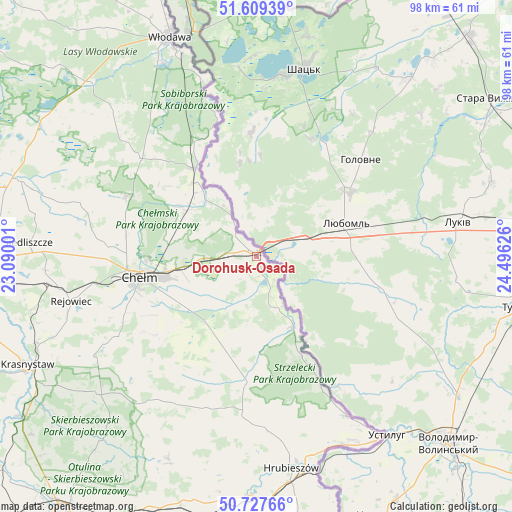
| Upper-left | 51.60939°, | 23.09001° |
| Center: | 51.17063°, | 23.79313° |
| Lower-right: | 50.72766°, | 24.49626° |
| Map W x H: | 98×98 km | = 60.9×60.9mi |
| max Lat: | 54.83135° ⇑49.8% North |
| Dorohusk-Osada: | 51.17063° |
| min Lat: | ⇓50.2% South 49.21328° |
| min Long | Dorohusk-Osada | max Long |
| 14.20249° | 23.79313° | 24.03723° |
| W 99.7%⇐ | ⇒0.3% E |
Elevation
Elevation of Dorohusk-Osada is 176 m = 577 ft, and this is 15.4 m = 51 ft below average elevation for this country.
| Max E: |
974 m = 3196 ft | 48.5% |
| Avg. | 191.4 m = 628 ft | |
| Dorohusk-Osada | 176 m = 577 ft | |
Min E: |
-3 m = -10 ft | 51.5% |
See also: Poland elevation on elevation.city.
Geographical zone
Dorohusk-Osada is located in North temperate zone (between Tropic of Cancer and the Arctic Circle). Distance of this North polar circle is 1711.5 km =1063.5 mi to North.| Distance of | km | miles | from Dorohusk-Osada |
|---|---|---|---|
| North Pole | 4317.4 | 2682.7 | to North |
| Arctic Circle | 1711.5 | 1063.5 | to North |
| Tropic Cancer | 3083.7 | 1916.1 | to South |
| Equator | 5689.6 | 3535.4 | to South |


Nearby cities:
15 places around Dorohusk-Osada: (largest is in red/bold)
• Białopole
21 km =13 mi,  191°
191°
• Chełm
22.6 km =14 mi,  262°
262°
• Dorohusk
1.9 km =1.2 mi,  158°
158°
• Dubienka
15.2 km =9.4 mi,  152°
152°
• Jarosławiec
29.9 km =18.6 mi, 192°
• Kamień
16.7 km =10.4 mi,  240°
240°
• Pokrówka
24.5 km =15.2 mi,  249°
249°
• Ruda-Huta
15.6 km =9.7 mi,  297°
297°
• Sawin
27.6 km =17.1 mi,  294°
294°
• Siedliszcze
16.4 km =10.2 mi,  318°
318°
• Uchanie
30.7 km =19.1 mi,  198°
198°
• Wojsławice
32.9 km =20.4 mi,  211°
211°
• Wola Uhruska
20.4 km =12.7 mi,  325°
325°
• Świerże
6.6 km =4.1 mi, 322°
• Żmudź
18.8 km =11.7 mi, 205°
Sources, notices
• [Note1] Compared only with cities in Poland existing in our database
• [Src1] Map data: © OpenStreetMap contributors (CC-BY-SA)
• [Src2] Other city data from geonames.org with taken over terms of usage.
• [Src3] Geographical zone / Annual Mean Temperature by Robert A. Rohde @ Wikipedia
