Dźwierzuty geodata
Dźwierzuty (Warmia-Masuria) is a populated place; located in Poland in Europe/Warsaw (GMT+2) time zone. With population of 1,380 people, there are 2003 cities with bigger population in this country. Compared to other cities in Poland, 91.4% of cities are located further ↓South; 71.9% of cities are located further ←West and 60.3% of cities have higher elevation than Dźwierzuty. Note1
Administrative division(s):
- Level 1: Warmia-Masuria
- Level 2: Powiat szczycieński
- Level 3: Dźwierzuty


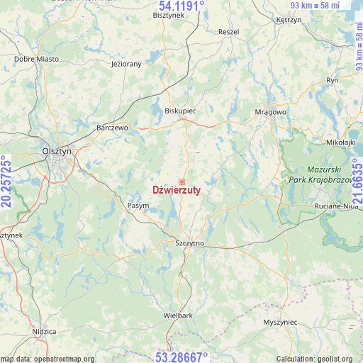
Dźwierzuty GPS coordinates[2]
53° 42' 17.784" North, 20° 57' 37.332" East
| Map corner | latitude | longitude |
|---|---|---|
| Upper-left | 54.1191°, | 20.25725° |
| Center: | 53.70494°, | 20.96037° |
| Lower-right: | 53.28667°, | 21.6635° |
| Map W x H: | 92.6×92.6 km | = 57.5×57.5mi |
| max Lat: | 54.83135° ⇑8.6% North |
| Dźwierzuty: | 53.70494° |
| min Lat: | ⇓91.4% South 49.21328° |
| min Long | Dźwierzuty | max Long |
| 14.20249° | 20.96037° | 24.03723° |
| W 71.9%⇐ | ⇒28.1% E |
Elevation
Elevation of Dźwierzuty is 146 m = 479 ft, and this is 45.4 m = 149 ft below average elevation for this country.
| Max E: |
974 m = 3196 ft | 60.3% |
| Avg. | 191.4 m = 628 ft | |
| Dźwierzuty | 146 m = 479 ft | |
Min E: |
-3 m = -10 ft | 39.7% |
See also: Poland elevation on elevation.city.
Geographical zone
Dźwierzuty is located in North temperate zone (between Tropic of Cancer and the Arctic Circle). Distance of this North polar circle is 1429.7 km =888.4 mi to North.| Distance of | km | miles | from Dźwierzuty |
|---|---|---|---|
| North Pole | 4035.6 | 2507.6 | to North |
| Arctic Circle | 1429.7 | 888.4 | to North |
| Tropic Cancer | 3365.5 | 2091.2 | to South |
| Equator | 5971.4 | 3710.5 | to South |


Nearby cities:
15 places around Dźwierzuty: (largest is in red/bold)
• Barczewo
22.5 km =14 mi,  308°
308°
• Biskupiec
17.8 km =11.1 mi,  359°
359°
• Czerwonka
23.9 km =14.9 mi,  349°
349°
• Jedwabno
24.8 km =15.4 mi,  218°
218°
• Jeziorany
33.2 km =20.6 mi,  335°
335°
• Kolno
32.5 km =20.2 mi,  3°
3°
• Kortowo
33.7 km =20.9 mi,  279°
279°
• Mrągowo
28.8 km =17.9 mi,  51°
51°
• Olsztyn
31.8 km =19.8 mi,  285°
285°
• Pasym
12.6 km =7.8 mi,  241°
241°
• Piecki
25.6 km =15.9 mi,  76°
76°
• Purda
16.7 km =10.4 mi,  271°
271°
• Sorkwity
19.6 km =12.2 mi,  37°
37°
• Szczytno
15.9 km =9.9 mi,  173°
173°
• Świętajno
22.8 km =14.2 mi,  132°
132°
Sources, notices
• [Note1] Compared only with cities in Poland existing in our database
• [Src1] Map data: © OpenStreetMap contributors (CC-BY-SA)
• [Src2] Other city data from geonames.org with taken over terms of usage.
• [Src3] Geographical zone / Annual Mean Temperature by Robert A. Rohde @ Wikipedia
