Dziadkowice geodata
Dziadkowice (Podlasie) is a seat of a third-order administrative division; located in Poland in Europe/Warsaw (GMT+2) time zone. In our database, there are 3649 cities with bigger population. Compared to other cities in Poland, 77.3% of cities are located further ↓South; 95.4% of cities are located further ←West and 52.1% of cities have higher elevation than Dziadkowice. Note1


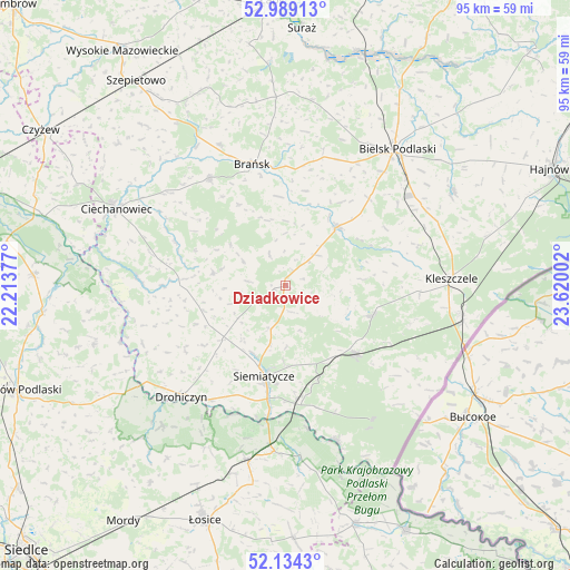
Dziadkowice GPS coordinates[2]
52° 33' 49.68" North, 22° 55' 0.804" East
| Map corner | latitude | longitude |
|---|---|---|
| Upper-left | 52.98913°, | 22.21377° |
| Center: | 52.5638°, | 22.91689° |
| Lower-right: | 52.1343°, | 23.62002° |
| Map W x H: | 95×95 km | = 59×59mi |
| max Lat: | 54.83135° ⇑22.7% North |
| Dziadkowice: | 52.5638° |
| min Lat: | ⇓77.3% South 49.21328° |
| min Long | Dziadkowice | max Long |
| 14.20249° | 22.91689° | 24.03723° |
| W 95.4%⇐ | ⇒4.6% E |
Elevation
Elevation of Dziadkowice is 166 m = 545 ft, and this is 25.4 m = 83 ft below average elevation for this country.
| Max E: |
974 m = 3196 ft | 52.1% |
| Avg. | 191.4 m = 628 ft | |
| Dziadkowice | 166 m = 545 ft | |
Min E: |
-3 m = -10 ft | 47.9% |
See also: Poland elevation on elevation.city.
Geographical zone
Dziadkowice is located in North temperate zone (between Tropic of Cancer and the Arctic Circle). Distance of this North polar circle is 1556.6 km =967.2 mi to North.| Distance of | km | miles | from Dziadkowice |
|---|---|---|---|
| North Pole | 4162.5 | 2586.5 | to North |
| Arctic Circle | 1556.6 | 967.2 | to North |
| Tropic Cancer | 3238.6 | 2012.4 | to South |
| Equator | 5844.5 | 3631.6 | to South |


Nearby cities:
15 places around Dziadkowice: (largest is in red/bold)
• Bielsk Podlaski
28.8 km =17.9 mi,  39°
39°
• Boćki
13 km =8.1 mi, 41°
• Brańsk
20.8 km =12.9 mi,  345°
345°
• Czeremcha
29.8 km =18.5 mi,  100°
100°
• Drohiczyn
25.2 km =15.7 mi,  223°
223°
• Grodzisk
12.3 km =7.6 mi,  280°
280°
• Kleszczele
27.6 km =17.1 mi,  87°
87°
• Mielnik
27.2 km =16.9 mi,  161°
161°
• Milejczyce
15.4 km =9.6 mi,  108°
108°
• Nurzec-Stacja
16 km =9.9 mi,  134°
134°
• Perlejewo
23.8 km =14.8 mi,  270°
270°
• Platerów
29.7 km =18.5 mi,  192°
192°
• Rudka
22 km =13.7 mi,  324°
324°
• Sarnaki
27.7 km =17.2 mi,  183°
183°
• Siemiatycze
15.6 km =9.7 mi, 193°
Sources, notices
• [Note1] Compared only with cities in Poland existing in our database
• [Src1] Map data: © OpenStreetMap contributors (CC-BY-SA)
• [Src2] Other city data from geonames.org with taken over terms of usage.
• [Src3] Geographical zone / Annual Mean Temperature by Robert A. Rohde @ Wikipedia
