Czerwińsk Nad Wisłą geodata
Czerwińsk Nad Wisłą (Mazovia) is a seat of a third-order administrative division; located in Poland in Europe/Warsaw (GMT+2) time zone. With population of 1,200 people, there are 2164 cities with bigger population in this country. Compared to other cities in Poland, 74.6% of cities are located further ↓South; 62.7% of cities are located further ←West and 83.7% of cities have higher elevation than Czerwińsk Nad Wisłą. Note1


Czerwińsk Nad Wisłą GPS coordinates[2]
52° 23' 53.808" North, 20° 18' 34.56" East
| Map corner | latitude | longitude |
|---|---|---|
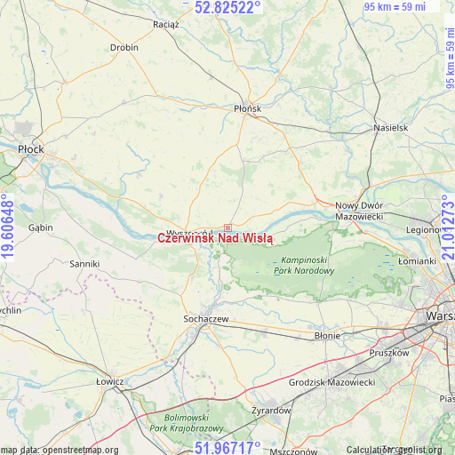
| Upper-left | 52.82522°, | 19.60648° |
| Center: | 52.39828°, | 20.3096° |
| Lower-right: | 51.96717°, | 21.01273° |
| Map W x H: | 95.4×95.4 km | = 59.3×59.3mi |
| max Lat: | 54.83135° ⇑25.4% North |
| Czerwińsk Nad Wisłą: | 52.39828° |
| min Lat: | ⇓74.6% South 49.21328° |
| min Long | Czerwińsk Nad | max Long |
| 14.20249° | 20.3096° | 24.03723° |
| W 62.7%⇐ | ⇒37.3% E |
Elevation
Elevation of Czerwińsk Nad Wisłą is 92 m = 302 ft, and this is 99.4 m = 326 ft below average elevation for this country.
| Max E: |
974 m = 3196 ft | 83.7% |
| Avg. | 191.4 m = 628 ft | |
| Czerwińsk Nad Wisłą | 92 m = 302 ft | |
Min E: |
-3 m = -10 ft | 16.3% |
See also: Poland elevation on elevation.city.
Geographical zone
Czerwińsk Nad Wisłą is located in North temperate zone (between Tropic of Cancer and the Arctic Circle). Distance of this North polar circle is 1575 km =978.7 mi to North.| Distance of | km | miles | from Czerwińsk Nad Wisłą |
|---|---|---|---|
| North Pole | 4180.9 | 2597.9 | to North |
| Arctic Circle | 1575 | 978.7 | to North |
| Tropic Cancer | 3220.2 | 2000.9 | to South |
| Equator | 5826.1 | 3620.2 | to South |


Nearby cities:
15 places around Czerwińsk Nad Wisłą: (largest is in red/bold)
• Bodzanów
22.1 km =13.7 mi,  300°
300°
• Brochów
9.3 km =5.8 mi,  200°
200°
• Bulkowo
20.5 km =12.7 mi,  320°
320°
• Czerwonka-Parcel
20.5 km =12.7 mi,  188°
188°
• Iłów
20.2 km =12.6 mi,  251°
251°
• Kampinos
17.8 km =11.1 mi,  144°
144°
• Mała Wieś
15.5 km =9.6 mi, 295°
• Młodzieszyn
13.3 km =8.3 mi,  214°
214°
• Naruszewo
14.6 km =9.1 mi,  11°
11°
• Paprotnia
22.8 km =14.2 mi,  160°
160°
• Rybno
22.3 km =13.9 mi,  219°
219°
• Sochaczew
19.4 km =12.1 mi, 194°
• Wyszogród
8.1 km =5 mi,  263°
263°
• Zakroczym
20.9 km =13 mi,  79°
79°
• Załuski
19.5 km =12.1 mi,  49°
49°
Sources, notices
• [Note1] Compared only with cities in Poland existing in our database
• [Src1] Map data: © OpenStreetMap contributors (CC-BY-SA)
• [Src2] Other city data from geonames.org with taken over terms of usage.
• [Src3] Geographical zone / Annual Mean Temperature by Robert A. Rohde @ Wikipedia
