Cholewiana Góra geodata
Cholewiana Góra (Subcarpathian) is a populated place; located in Poland in Europe/Warsaw (GMT+2) time zone. With population of 884 people, there are 2704 cities with bigger population in this country. Compared to other cities in Poland, 70.8% of cities are located further ↑North; 85.7% of cities are located further ←West and 54.4% of cities have lower elevation than Cholewiana Góra. Note1


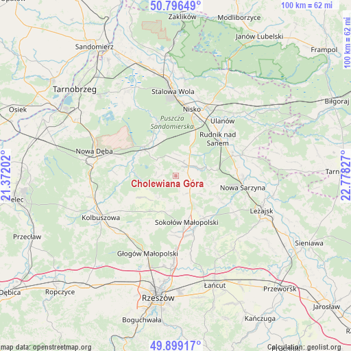
Cholewiana Góra GPS coordinates[2]
50° 20' 59.82" North, 22° 4' 30.504" East
| Map corner | latitude | longitude |
|---|---|---|
| Upper-left | 50.79649°, | 21.37202° |
| Center: | 50.34995°, | 22.07514° |
| Lower-right: | 49.89917°, | 22.77827° |
| Map W x H: | 99.8×99.8 km | = 62×62mi |
| max Lat: | 54.83135° ⇑70.8% North |
| Cholewiana Góra: | 50.34995° |
| min Lat: | ⇓29.2% South 49.21328° |
| min Long | Cholewiana Gór | max Long |
| 14.20249° | 22.07514° | 24.03723° |
| W 85.7%⇐ | ⇒14.3% E |
Elevation
Elevation of Cholewiana Góra is 183 m = 600 ft, and this is 8.4 m = 28 ft below average elevation for this country.
| Max E: |
974 m = 3196 ft | 45.6% |
| Avg. | 191.4 m = 628 ft | |
| Cholewiana Góra | 183 m = 600 ft | |
Min E: |
-3 m = -10 ft | 54.4% |
See also: Poland elevation on elevation.city.
Geographical zone
Cholewiana Góra is located in North temperate zone (between Tropic of Cancer and the Arctic Circle). Distance of this North polar circle is 1802.8 km =1120.2 mi to North.| Distance of | km | miles | from Cholewiana Góra |
|---|---|---|---|
| North Pole | 4408.7 | 2739.4 | to North |
| Arctic Circle | 1802.8 | 1120.2 | to North |
| Tropic Cancer | 2992.5 | 1859.5 | to South |
| Equator | 5598.4 | 3478.7 | to South |


Nearby cities:
15 places around Cholewiana Góra: (largest is in red/bold)
• Bojanów
12.1 km =7.5 mi,  313°
313°
• Gwoździec
6.6 km =4.1 mi,  295°
295°
• Górno
9 km =5.6 mi,  146°
146°
• Jeżowe
4.6 km =2.9 mi,  53°
53°
• Kamień
4.4 km =2.7 mi,  103°
103°
• Kończyce
10.1 km =6.3 mi,  33°
33°
• Lipnica
14.9 km =9.3 mi,  243°
243°
• Raniżów
12.5 km =7.8 mi,  216°
216°
• Rudnik nad Sanem
16 km =9.9 mi, 50°
• Sokołów Małopolski
13.8 km =8.6 mi,  166°
166°
• Tarnogóra
17.4 km =10.8 mi,  83°
83°
• Wola Żarczycka
14 km =8.7 mi,  117°
117°
• Wólka Niedźwiedzka
14.4 km =8.9 mi, 146°
• Wólka Łętowska
9.8 km =6.1 mi,  107°
107°
• Łętownia
11.6 km =7.2 mi, 103°
Sources, notices
• [Note1] Compared only with cities in Poland existing in our database
• [Src1] Map data: © OpenStreetMap contributors (CC-BY-SA)
• [Src2] Other city data from geonames.org with taken over terms of usage.
• [Src3] Geographical zone / Annual Mean Temperature by Robert A. Rohde @ Wikipedia
