Bieniewice geodata
Bieniewice (Mazovia) is a populated place; located in Poland in Europe/Warsaw (GMT+2) time zone. With population of 1,129 people, there are 2271 cities with bigger population in this country. Compared to other cities in Poland, 69.7% of cities are located further ↓South; 65.9% of cities are located further ←West and 84.1% of cities have higher elevation than Bieniewice. Note1


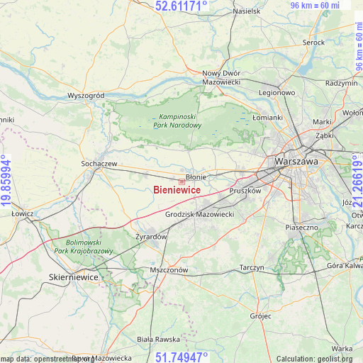
Bieniewice GPS coordinates[2]
52° 10' 57.648" North, 20° 33' 47.016" East
| Map corner | latitude | longitude |
|---|---|---|
| Upper-left | 52.61171°, | 19.85994° |
| Center: | 52.18268°, | 20.56306° |
| Lower-right: | 51.74947°, | 21.26619° |
| Map W x H: | 95.9×95.9 km | = 59.6×59.6mi |
| max Lat: | 54.83135° ⇑30.3% North |
| Bieniewice: | 52.18268° |
| min Lat: | ⇓69.7% South 49.21328° |
| min Long | Bieniewice | max Long |
| 14.20249° | 20.56306° | 24.03723° |
| W 65.9%⇐ | ⇒34.1% E |
Elevation
Elevation of Bieniewice is 91 m = 299 ft, and this is 100.4 m = 329 ft below average elevation for this country.
| Max E: |
974 m = 3196 ft | 84.1% |
| Avg. | 191.4 m = 628 ft | |
| Bieniewice | 91 m = 299 ft | |
Min E: |
-3 m = -10 ft | 15.9% |
See also: Poland elevation on elevation.city.
Geographical zone
Bieniewice is located in North temperate zone (between Tropic of Cancer and the Arctic Circle). Distance of this North polar circle is 1599 km =993.6 mi to North.| Distance of | km | miles | from Bieniewice |
|---|---|---|---|
| North Pole | 4204.9 | 2612.8 | to North |
| Arctic Circle | 1599 | 993.6 | to North |
| Tropic Cancer | 3196.3 | 1986.1 | to South |
| Equator | 5802.2 | 3605.3 | to South |


Nearby cities:
15 places around Bieniewice: (largest is in red/bold)
• Boża Wola
2.7 km =1.7 mi,  278°
278°
• Brwinów
11.4 km =7.1 mi,  112°
112°
• Błonie
4.1 km =2.5 mi,  64°
64°
• Grodzisk Mazowiecki
10 km =6.2 mi,  151°
151°
• Jaktorów
11.7 km =7.3 mi,  185°
185°
• Józefów
9.2 km =5.7 mi,  81°
81°
• Kampinos
11.7 km =7.3 mi,  324°
324°
• Leszno
8.6 km =5.3 mi,  12°
12°
• Milanówek
10.3 km =6.4 mi,  133°
133°
• Owczarnia
12.5 km =7.8 mi, 129°
• Ołtarzew
13.8 km =8.6 mi, 76°
• Paprotnia
9.9 km =6.2 mi, 284°
• Podkowa Leśna
13 km =8.1 mi,  121°
121°
• Teresin
10.1 km =6.3 mi, 280°
• Zaborów
11.8 km =7.3 mi,  41°
41°
Sources, notices
• [Note1] Compared only with cities in Poland existing in our database
• [Src1] Map data: © OpenStreetMap contributors (CC-BY-SA)
• [Src2] Other city data from geonames.org with taken over terms of usage.
• [Src3] Geographical zone / Annual Mean Temperature by Robert A. Rohde @ Wikipedia
