Biała Piska geodata
Biała Piska (Warmia-Masuria) is a seat of a third-order administrative division; located in Poland in Europe/Warsaw (GMT+2) time zone. With population of 4,027 people, there are 810 cities with bigger population in this country. Compared to other cities in Poland, 90.8% of cities are located further ↓South; 85.6% of cities are located further ←West and 63.4% of cities have higher elevation than Biała Piska. Note1


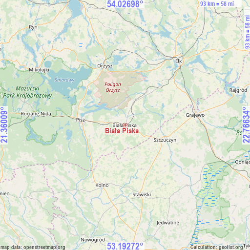
Biała Piska GPS coordinates[2]
53° 36' 42.876" North, 22° 3' 47.556" East
| Map corner | latitude | longitude |
|---|---|---|
| Upper-left | 54.02698°, | 21.36009° |
| Center: | 53.61191°, | 22.06321° |
| Lower-right: | 53.19272°, | 22.76634° |
| Map W x H: | 92.8×92.8 km | = 57.7×57.7mi |
| max Lat: | 54.83135° ⇑9.2% North |
| Biała Piska: | 53.61191° |
| min Lat: | ⇓90.8% South 49.21328° |
| min Long | Biała Piska | max Long |
| 14.20249° | 22.06321° | 24.03723° |
| W 85.6%⇐ | ⇒14.4% E |
Elevation
Elevation of Biała Piska is 138 m = 453 ft, and this is 53.4 m = 175 ft below average elevation for this country.
| Max E: |
974 m = 3196 ft | 63.4% |
| Avg. | 191.4 m = 628 ft | |
| Biała Piska | 138 m = 453 ft | |
Min E: |
-3 m = -10 ft | 36.6% |
See also: Poland elevation on elevation.city.
Geographical zone
Biała Piska is located in North temperate zone (between Tropic of Cancer and the Arctic Circle). Distance of this North polar circle is 1440.1 km =894.8 mi to North.| Distance of | km | miles | from Biała Piska |
|---|---|---|---|
| North Pole | 4046 | 2514.1 | to North |
| Arctic Circle | 1440.1 | 894.8 | to North |
| Tropic Cancer | 3355.2 | 2084.8 | to South |
| Equator | 5961.1 | 3704.1 | to South |


Nearby cities:
15 places around Biała Piska: (largest is in red/bold)
• Ełk
31.2 km =19.4 mi,  39°
39°
• Grabowo
17.3 km =10.7 mi,  159°
159°
• Grajewo
26.2 km =16.3 mi,  81°
81°
• Janowo
30.4 km =18.9 mi,  198°
198°
• Kolno
24 km =14.9 mi, 201°
• Mały Płock
34.3 km =21.3 mi,  183°
183°
• Orzysz
23.3 km =14.5 mi,  340°
340°
• Pisz
16.6 km =10.3 mi,  275°
275°
• Prostki
26.1 km =16.2 mi,  68°
68°
• Radziłów
32.1 km =19.9 mi,  134°
134°
• Ruciane-Nida
34.7 km =21.6 mi, 275°
• Stare Juchy
35.2 km =21.9 mi,  11°
11°
• Stawiski
26.5 km =16.5 mi,  166°
166°
• Szczuczyn
15.6 km =9.7 mi,  110°
110°
• Wąsosz
19.6 km =12.2 mi,  120°
120°
Sources, notices
• [Note1] Compared only with cities in Poland existing in our database
• [Src1] Map data: © OpenStreetMap contributors (CC-BY-SA)
• [Src2] Other city data from geonames.org with taken over terms of usage.
• [Src3] Geographical zone / Annual Mean Temperature by Robert A. Rohde @ Wikipedia
