Srednebelaya geodata
Srednebelaya (Amur Oblast) is a populated place; located in Russia in Asia/Yakutsk (GMT+9) time zone. With population of 6,148 people, there are 2217 cities with bigger population in this country. Compared to other cities in Russia, 76.1% of cities are located further ↑North; 93.8% of cities are located further ←West and 53.9% of cities have lower elevation than Srednebelaya. Note1


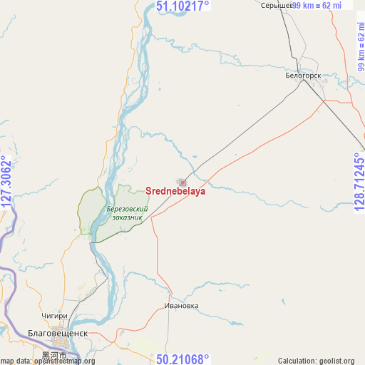
Srednebelaya GPS coordinates[2]
50° 39' 30.744" North, 128° 0' 33.552" East
| Map corner | latitude | longitude |
|---|---|---|
| Upper-left | 51.10217°, | 127.3062° |
| Center: | 50.65854°, | 128.00932° |
| Lower-right: | 50.21068°, | 128.71245° |
| Map W x H: | 99.1×99.1 km | = 61.6×61.6mi |
| max Lat: | 73.50819° ⇑76.1% North |
| Srednebelaya: | 50.65854° |
| min Lat: | ⇓23.9% South 41.28413° |
| min Long | Srednebelaya | max Long |
| -179.12198° | 128.00932° | 179.35046° |
| W 93.8%⇐ | ⇒6.2% E |
Elevation
Elevation of Srednebelaya is 154 m = 505 ft, and this is 48.6 m = 159 ft below average elevation for this country.
| Max E: |
2518 m = 8261 ft | 46.1% |
| Avg. | 202.6 m = 665 ft | |
| Srednebelaya | 154 m = 505 ft | |
Min E: |
-28 m = -92 ft | 53.9% |
See also: Russia elevation on elevation.city.
Geographical zone
Srednebelaya is located in North temperate zone (between Tropic of Cancer and the Arctic Circle). Distance of this North polar circle is 1768.5 km =1098.9 mi to North.| Distance of | km | miles | from Srednebelaya |
|---|---|---|---|
| North Pole | 4374.4 | 2718.1 | to North |
| Arctic Circle | 1768.5 | 1098.9 | to North |
| Tropic Cancer | 3026.8 | 1880.8 | to South |
| Equator | 5632.7 | 3500 | to South |


Nearby cities:
15 places around Srednebelaya: (largest is in red/bold)
• Belogorsk
43.6 km =27.1 mi,  48°
48°
• Blagoveshchensk
53.6 km =33.3 mi,  218°
218°
• Konstantinovka
115.6 km =71.8 mi,  180°
180°
• Novoraychikhinsk
148.7 km =92.4 mi,  130°
130°
• Poyarkovo
123.6 km =76.8 mi,  158°
158°
• Raychikhinsk
138.8 km =86.2 mi, 134°
• Romny
90.6 km =56.3 mi,  85°
85°
• Seryshevo
55 km =34.2 mi,  28°
28°
• Shimanovsk
151.6 km =94.2 mi,  351°
351°
• Shirokiy
146.8 km =91.2 mi, 132°
• Svobodnyy
80.2 km =49.8 mi,  6°
6°
• Tambovka
62.2 km =38.6 mi, 176°
• Tsiolkovskiy
123.5 km =76.7 mi,  3°
3°
• Yekaterinoslavka
84 km =52.2 mi,  112°
112°
• Zavitinsk
118.4 km =73.6 mi,  120°
120°
Sources, notices
• [Note1] Compared only with cities in Russia existing in our database
• [Src1] Map data: © OpenStreetMap contributors (CC-BY-SA)
• [Src2] Other city data from geonames.org with taken over terms of usage.
• [Src3] Geographical zone / Annual Mean Temperature by Robert A. Rohde @ Wikipedia
