Zapolyarnyy geodata
Zapolyarnyy (Komi) is a populated place; located in Russia in Europe/Moscow (GMT+3) time zone. With population of 4,476 people, there are 2875 cities with bigger population in this country. Compared to other cities in Russia, 98.7% of cities are located further ↓South; 75.2% of cities are located further ←West and 67.1% of cities have lower elevation than Zapolyarnyy. Note1


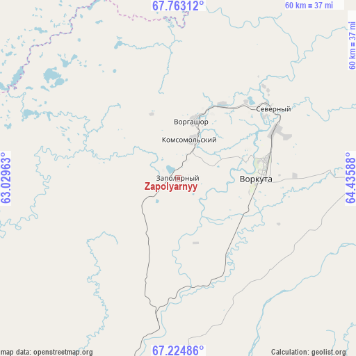
Zapolyarnyy GPS coordinates[2]
67° 29' 43.872" North, 63° 43' 57.9" East
| Map corner | latitude | longitude |
|---|---|---|
| Upper-left | 67.76312°, | 63.02963° |
| Center: | 67.49552°, | 63.73275° |
| Lower-right: | 67.22486°, | 64.43588° |
| Map W x H: | 59.8×59.8 km | = 37.2×37.2mi |
| max Lat: | 73.50819° ⇑1.3% North |
| Zapolyarnyy: | 67.49552° |
| min Lat: | ⇓98.7% South 41.28413° |
| min Long | Zapolyarnyy | max Long |
| -179.12198° | 63.73275° | 179.35046° |
| W 75.2%⇐ | ⇒24.8% E |
Elevation
Elevation of Zapolyarnyy is 188 m = 617 ft, and this is 14.6 m = 48 ft below average elevation for this country.
| Max E: |
2518 m = 8261 ft | 32.9% |
| Avg. | 202.6 m = 665 ft | |
| Zapolyarnyy | 188 m = 617 ft | |
Min E: |
-28 m = -92 ft | 67.1% |
See also: Russia elevation on elevation.city.
Geographical zone
Zapolyarnyy is located in North Frigid zone (between North Pole and Arctic Circle). Distance of this North polar circle is 103.6 km =64.4 mi to South.| Distance of | km | miles | from Zapolyarnyy |
|---|---|---|---|
| North Pole | 2502.3 | 1554.9 | to North |
| Arctic Circle | 103.6 | 64.4 | to South |
| Tropic Cancer | 4898.9 | 3044 | to South |
| Equator | 7504.8 | 4663.3 | to South |


Nearby cities:
15 places around Zapolyarnyy: (largest is in red/bold)
• Amderma
265.1 km =164.7 mi,  341°
341°
• Berëzovo
400 km =248.5 mi,  171°
171°
• Inta
225.7 km =140.2 mi,  223°
223°
• Kharp
118.3 km =73.5 mi,  130°
130°
• Laborovaya
162.8 km =101.2 mi,  84°
84°
• Labytnangi
149 km =92.6 mi, 128°
• Muzhi
236.9 km =147.2 mi, 169°
• Promyshlennyy
12.5 km =7.8 mi,  38°
38°
• Salekhard
164.4 km =102.2 mi, 130°
• Sovetskiy
29.1 km =18.1 mi,  92°
92°
• Tsementnozavodskiy
21.2 km =13.2 mi,  45°
45°
• Verkhnyaya Inta
225.7 km =140.2 mi, 221°
• Vorgashor
10.1 km =6.3 mi,  14°
14°
• Vorkuta
13.6 km =8.5 mi, 88°
• Yeletskiy
54.1 km =33.6 mi,  157°
157°
Sources, notices
• [Note1] Compared only with cities in Russia existing in our database
• [Src1] Map data: © OpenStreetMap contributors (CC-BY-SA)
• [Src2] Other city data from geonames.org with taken over terms of usage.
• [Src3] Geographical zone / Annual Mean Temperature by Robert A. Rohde @ Wikipedia
