Kharp geodata
Kharp (Yamalo-Nenets) is a populated place; located in Russia in Asia/Yekaterinburg (GMT+5) time zone. With population of 7,298 people, there are 1933 cities with bigger population in this country. Compared to other cities in Russia, 98.4% of cities are located further ↓South; 76.2% of cities are located further ←West and 80.6% of cities have higher elevation than Kharp. Note1


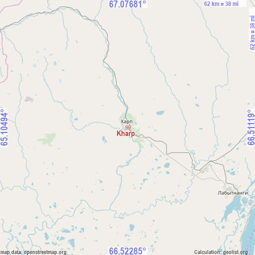
Kharp GPS coordinates[2]
66° 48' 5.004" North, 65° 48' 29.016" East
| Map corner | latitude | longitude |
|---|---|---|
| Upper-left | 67.07681°, | 65.10494° |
| Center: | 66.80139°, | 65.80806° |
| Lower-right: | 66.52285°, | 66.51119° |
| Map W x H: | 61.6×61.6 km | = 38.3×38.3mi |
| max Lat: | 73.50819° ⇑1.6% North |
| Kharp: | 66.80139° |
| min Lat: | ⇓98.4% South 41.28413° |
| min Long | Kharp | max Long |
| -179.12198° | 65.80806° | 179.35046° |
| W 76.2%⇐ | ⇒23.8% E |
Elevation
Elevation of Kharp is 69 m = 226 ft, and this is 133.6 m = 438 ft below average elevation for this country.
| Max E: |
2518 m = 8261 ft | 80.6% |
| Avg. | 202.6 m = 665 ft | |
| Kharp | 69 m = 226 ft | |
Min E: |
-28 m = -92 ft | 19.4% |
See also: Russia elevation on elevation.city.
Geographical zone
Kharp is located in North Frigid zone (between North Pole and Arctic Circle). Distance of this North polar circle is 26.4 km =16.4 mi to South.| Distance of | km | miles | from Kharp |
|---|---|---|---|
| North Pole | 2579.4 | 1602.8 | to North |
| Arctic Circle | 26.4 | 16.4 | to South |
| Tropic Cancer | 4821.7 | 2996.1 | to South |
| Equator | 7427.6 | 4615.3 | to South |


Nearby cities:
15 places around Kharp: (largest is in red/bold)
• Aksarka
91.6 km =56.9 mi,  107°
107°
• Beloyarskiy
345.9 km =214.9 mi,  173°
173°
• Berëzovo
320.3 km =199 mi,  186°
186°
• Igrim
406.8 km =252.8 mi, 189°
• Laborovaya
119.7 km =74.4 mi,  38°
38°
• Labytnangi
31.2 km =19.4 mi,  120°
120°
• Muzhi
163.5 km =101.6 mi,  197°
197°
• Promyshlennyy
119.2 km =74.1 mi,  316°
316°
• Salekhard
46.2 km =28.7 mi,  130°
130°
• Sovetskiy
96.7 km =60.1 mi, 321°
• Tsementnozavodskiy
118 km =73.3 mi, 321°
• Vorgashor
122.9 km =76.4 mi, 315°
• Vorkuta
108.4 km =67.4 mi, 315°
• Yeletskiy
74.6 km =46.4 mi,  291°
291°
• Zapolyarnyy
118.3 km =73.5 mi,  310°
310°
Sources, notices
• [Note1] Compared only with cities in Russia existing in our database
• [Src1] Map data: © OpenStreetMap contributors (CC-BY-SA)
• [Src2] Other city data from geonames.org with taken over terms of usage.
• [Src3] Geographical zone / Annual Mean Temperature by Robert A. Rohde @ Wikipedia
