Vorgashor geodata
Vorgashor (Komi) is a populated place; located in Russia in Europe/Moscow (GMT+3) time zone. With population of 18,946 people, there are 911 cities with bigger population in this country. Compared to other cities in Russia, 98.8% of cities are located further ↓South; 75.3% of cities are located further ←West and 70.4% of cities have lower elevation than Vorgashor. Note1


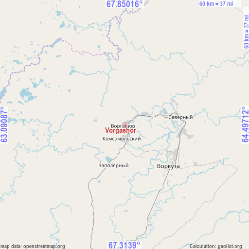
Vorgashor GPS coordinates[2]
67° 35' 0.78" North, 63° 47' 38.364" East
| Map corner | latitude | longitude |
|---|---|---|
| Upper-left | 67.85016°, | 63.09087° |
| Center: | 67.58355°, | 63.79399° |
| Lower-right: | 67.3139°, | 64.49712° |
| Map W x H: | 59.6×59.6 km | = 37×37mi |
| max Lat: | 73.50819° ⇑1.2% North |
| Vorgashor: | 67.58355° |
| min Lat: | ⇓98.8% South 41.28413° |
| min Long | Vorgashor | max Long |
| -179.12198° | 63.79399° | 179.35046° |
| W 75.3%⇐ | ⇒24.7% E |
Elevation
Elevation of Vorgashor is 199 m = 653 ft, and this is 3.6 m = 12 ft below average elevation for this country.
| Max E: |
2518 m = 8261 ft | 29.6% |
| Avg. | 202.6 m = 665 ft | |
| Vorgashor | 199 m = 653 ft | |
Min E: |
-28 m = -92 ft | 70.4% |
See also: Russia elevation on elevation.city.
Geographical zone
Vorgashor is located in North Frigid zone (between North Pole and Arctic Circle). Distance of this North polar circle is 113.4 km =70.5 mi to South.| Distance of | km | miles | from Vorgashor |
|---|---|---|---|
| North Pole | 2492.5 | 1548.8 | to North |
| Arctic Circle | 113.4 | 70.5 | to South |
| Tropic Cancer | 4908.7 | 3050.1 | to South |
| Equator | 7514.6 | 4669.4 | to South |


Nearby cities:
15 places around Vorgashor: (largest is in red/bold)
• Amderma
256.6 km =159.4 mi,  340°
340°
• Berëzovo
409.3 km =254.3 mi,  172°
172°
• Inta
234.5 km =145.7 mi,  222°
222°
• Kharp
122.9 km =76.4 mi,  135°
135°
• Laborovaya
159.2 km =98.9 mi,  87°
87°
• Labytnangi
153.2 km =95.2 mi,  132°
132°
• Muzhi
246.1 km =152.9 mi, 170°
• Promyshlennyy
5.2 km =3.2 mi, 90°
• Salekhard
168.9 km =104.9 mi, 133°
• Sovetskiy
28.7 km =17.8 mi,  112°
112°
• Tsementnozavodskiy
13.5 km =8.4 mi,  68°
68°
• Verkhnyaya Inta
234.6 km =145.8 mi, 220°
• Vorkuta
14.5 km =9 mi, 130°
• Yeletskiy
62.4 km =38.8 mi,  163°
163°
• Zapolyarnyy
10.1 km =6.3 mi,  194°
194°
Sources, notices
• [Note1] Compared only with cities in Russia existing in our database
• [Src1] Map data: © OpenStreetMap contributors (CC-BY-SA)
• [Src2] Other city data from geonames.org with taken over terms of usage.
• [Src3] Geographical zone / Annual Mean Temperature by Robert A. Rohde @ Wikipedia
