Laborovaya geodata
Laborovaya (Yamalo-Nenets) is a populated place; located in Russia in Asia/Yekaterinburg (GMT+5) time zone. With population of 700 people, there are 4812 cities with bigger population in this country. Compared to other cities in Russia, 98.9% of cities are located further ↓South; 76.7% of cities are located further ←West and 87.5% of cities have higher elevation than Laborovaya. Note1


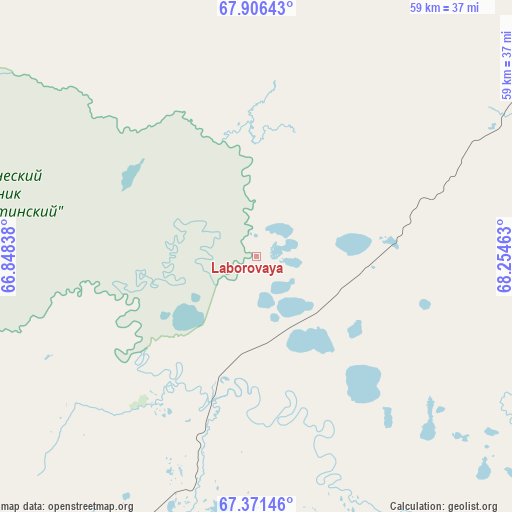
Laborovaya GPS coordinates[2]
67° 38' 25.656" North, 67° 33' 5.4" East
| Map corner | latitude | longitude |
|---|---|---|
| Upper-left | 67.90643°, | 66.84838° |
| Center: | 67.64046°, | 67.5515° |
| Lower-right: | 67.37146°, | 68.25463° |
| Map W x H: | 59.5×59.5 km | = 37×37mi |
| max Lat: | 73.50819° ⇑1.1% North |
| Laborovaya: | 67.64046° |
| min Lat: | ⇓98.9% South 41.28413° |
| min Long | Laborovaya | max Long |
| -179.12198° | 67.5515° | 179.35046° |
| W 76.7%⇐ | ⇒23.3% E |
Elevation
Elevation of Laborovaya is 38 m = 125 ft, and this is 164.6 m = 540 ft below average elevation for this country.
| Max E: |
2518 m = 8261 ft | 87.5% |
| Avg. | 202.6 m = 665 ft | |
| Laborovaya | 38 m = 125 ft | |
Min E: |
-28 m = -92 ft | 12.5% |
See also: Russia elevation on elevation.city.
Geographical zone
Laborovaya is located in North Frigid zone (between North Pole and Arctic Circle). Distance of this North polar circle is 119.7 km =74.4 mi to South.| Distance of | km | miles | from Laborovaya |
|---|---|---|---|
| North Pole | 2486.1 | 1544.8 | to North |
| Arctic Circle | 119.7 | 74.4 | to South |
| Tropic Cancer | 4915 | 3054 | to South |
| Equator | 7520.9 | 4673.3 | to South |


Nearby cities:
14 places around Laborovaya: (largest is in red/bold)
• Aksarka
120.5 km =74.9 mi,  174°
174°
• Kharp
119.7 km =74.4 mi,  218°
218°
• Kutop’yugan
190.4 km =118.3 mi,  139°
139°
• Labytnangi
119.8 km =74.4 mi,  204°
204°
• Muzhi
279.2 km =173.5 mi,  206°
206°
• Promyshlennyy
154 km =95.7 mi,  267°
267°
• Salekhard
130.1 km =80.8 mi, 198°
• Sovetskiy
134.2 km =83.4 mi,  262°
262°
• Tsementnozavodskiy
146.5 km =91 mi, 269°
• Vorgashor
159.2 km =98.9 mi, 267°
• Vorkuta
149.3 km =92.8 mi, 263°
• Yar-Sale
165.5 km =102.8 mi,  121°
121°
• Yeletskiy
157.5 km =97.9 mi,  245°
245°
• Zapolyarnyy
162.8 km =101.2 mi, 264°
Sources, notices
• [Note1] Compared only with cities in Russia existing in our database
• [Src1] Map data: © OpenStreetMap contributors (CC-BY-SA)
• [Src2] Other city data from geonames.org with taken over terms of usage.
• [Src3] Geographical zone / Annual Mean Temperature by Robert A. Rohde @ Wikipedia
