Yeletskiy geodata
Yeletskiy (Komi) is a populated place; located in Russia in Europe/Moscow (GMT+3) time zone. With population of 742 people, there are 4787 cities with bigger population in this country. Compared to other cities in Russia, 98.5% of cities are located further ↓South; 75.4% of cities are located further ←West and 65% of cities have higher elevation than Yeletskiy. Note1


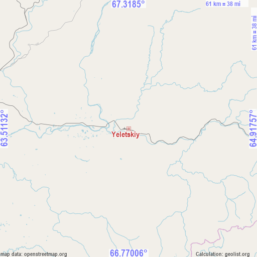
Yeletskiy GPS coordinates[2]
67° 2' 44.988" North, 64° 12' 51.984" East
| Map corner | latitude | longitude |
|---|---|---|
| Upper-left | 67.3185°, | 63.51132° |
| Center: | 67.04583°, | 64.21444° |
| Lower-right: | 66.77006°, | 64.91757° |
| Map W x H: | 61×61 km | = 37.9×37.9mi |
| max Lat: | 73.50819° ⇑1.5% North |
| Yeletskiy: | 67.04583° |
| min Lat: | ⇓98.5% South 41.28413° |
| min Long | Yeletskiy | max Long |
| -179.12198° | 64.21444° | 179.35046° |
| W 75.4%⇐ | ⇒24.6% E |
Elevation
Elevation of Yeletskiy is 114 m = 374 ft, and this is 88.6 m = 291 ft below average elevation for this country.
| Max E: |
2518 m = 8261 ft | 65% |
| Avg. | 202.6 m = 665 ft | |
| Yeletskiy | 114 m = 374 ft | |
Min E: |
-28 m = -92 ft | 35% |
See also: Russia elevation on elevation.city.
Geographical zone
Yeletskiy is located in North Frigid zone (between North Pole and Arctic Circle). Distance of this North polar circle is 53.6 km =33.3 mi to South.| Distance of | km | miles | from Yeletskiy |
|---|---|---|---|
| North Pole | 2552.3 | 1585.9 | to North |
| Arctic Circle | 53.6 | 33.3 | to South |
| Tropic Cancer | 4848.9 | 3013 | to South |
| Equator | 7454.8 | 4632.2 | to South |


Nearby cities:
15 places around Yeletskiy: (largest is in red/bold)
• Aksarka
165.9 km =103.1 mi,  108°
108°
• Amderma
319 km =198.2 mi,  340°
340°
• Berëzovo
347.6 km =216 mi,  173°
173°
• Igrim
428.8 km =266.4 mi,  178°
178°
• Kharp
74.6 km =46.4 mi, 111°
• Laborovaya
157.5 km =97.9 mi,  65°
65°
• Labytnangi
105.6 km =65.6 mi, 114°
• Muzhi
184.3 km =114.5 mi, 173°
• Promyshlennyy
61.1 km =38 mi,  347°
347°
• Salekhard
119.3 km =74.1 mi,  118°
118°
• Sovetskiy
49.4 km =30.7 mi,  10°
10°
• Tsementnozavodskiy
65 km =40.4 mi,  355°
355°
• Vorgashor
62.4 km =38.8 mi, 343°
• Vorkuta
50.8 km =31.6 mi, 352°
• Zapolyarnyy
54.1 km =33.6 mi, 337°
Sources, notices
• [Note1] Compared only with cities in Russia existing in our database
• [Src1] Map data: © OpenStreetMap contributors (CC-BY-SA)
• [Src2] Other city data from geonames.org with taken over terms of usage.
• [Src3] Geographical zone / Annual Mean Temperature by Robert A. Rohde @ Wikipedia
