Touba geodata
Touba (Diourbel) is a populated place; located in Senegal in Africa/Dakar (GMT+0) time zone. With population of 529,176 people, there are 2 cities with bigger population in this country. Compared to other cities in Senegal, 68.3% of cities are located further ↓South; 63.3% of cities are located further ←West and 93.3% of cities have lower elevation than Touba. Note1


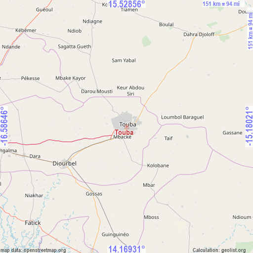
Touba GPS coordinates[2]
14° 51' 0" North, 15° 52' 59.988" West
| Map corner | latitude | longitude |
|---|---|---|
| Upper-left | 15.52856°, | -16.58646° |
| Center: | 14.85°, | -15.88333° |
| Lower-right: | 14.16931°, | -15.18021° |
| Map W x H: | 151.1×151.1 km | = 93.9×93.9mi |
| max Lat: | 16.51293° ⇑31.7% North |
| Touba: | 14.85° |
| min Lat: | ⇓68.3% South 12.485° |
| min Long | Touba | max Long |
| -17.47581° | -15.88333° | -12.18076° |
| W 63.3%⇐ | ⇒36.7% E |
Elevation
Elevation of Touba is 46 m = 151 ft, and this is 21.5 m = 71 ft above average elevation for this country.
| Max E: |
127 m = 417 ft | 6.7% |
| Touba | 46 m 151 ft | |
| Avg. | 24.5 m = 80 ft | |
Min E: |
0 m = 0 ft | 93.3% |
See also: Touba elevation on elevation.city.
Geographical zone
Touba is located in North Torrid zone (between Equator and Tropic of Cancer). Distance of this Northern Tropic circle is 954.8 km =593.3 mi to North.| Distance of | km | miles | from Touba |
|---|---|---|---|
| North Pole | 8355.9 | 5192.1 | to North |
| Arctic Circle | 5750 | 3572.9 | to North |
| Tropic Cancer | 954.8 | 593.3 | to North |
| Equator | 1651.2 | 1026 | to South |


Nearby cities:
15 places around Touba: (largest is in red/bold)
• Dara
70.3 km =43.7 mi,  38°
38°
• Diourbel
44.8 km =27.8 mi,  239°
239°
• Fatick
80.4 km =50 mi,  224°
224°
• Gandiaye
80 km =49.7 mi,  211°
211°
• Guinguinéo
65.3 km =40.6 mi,  186°
186°
• Guéoul
86.4 km =53.7 mi,  324°
324°
• Kaffrine
90.1 km =56 mi,  156°
156°
• Kaolack
80.2 km =49.8 mi, 194°
• Khombole
88.3 km =54.9 mi,  263°
263°
• Louga
93 km =57.8 mi,  336°
336°
• Mbaké
7.1 km =4.4 mi,  201°
201°
• Mékhé
84.4 km =52.4 mi,  290°
290°
• Ndibène Dahra
69.3 km =43.1 mi, 39°
• Pourham
79.9 km =49.6 mi,  225°
225°
• Tiébo
44.7 km =27.8 mi, 237°
Sources, notices
• [Note1] Compared only with cities in Senegal existing in our database
• [Src1] Map data: © OpenStreetMap contributors (CC-BY-SA)
• [Src2] Other city data from geonames.org with taken over terms of usage.
• [Src3] Geographical zone / Annual Mean Temperature by Robert A. Rohde @ Wikipedia
