Ndibène Dahra geodata
Ndibène Dahra (Louga) is a populated place; located in Senegal in Africa/Dakar (GMT+0) time zone. With population of 27,741 people, there are 18 cities with bigger population in this country. Compared to other cities in Senegal, 81.7% of cities are located further ↓South; 75% of cities are located further ←West and 85% of cities have lower elevation than Ndibène Dahra. Note1


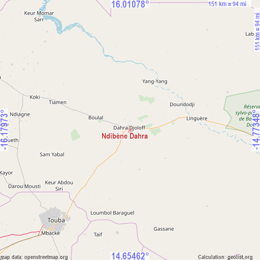
Ndibène Dahra GPS coordinates[2]
15° 20' 1.68" North, 15° 28' 35.76" West
| Map corner | latitude | longitude |
|---|---|---|
| Upper-left | 16.01078°, | -16.17973° |
| Center: | 15.3338°, | -15.4766° |
| Lower-right: | 14.65462°, | -14.77348° |
| Map W x H: | 150.8×150.8 km | = 93.7×93.7mi |
| max Lat: | 16.51293° ⇑18.3% North |
| Ndibène Dahra: | 15.3338° |
| min Lat: | ⇓81.7% South 12.485° |
| min Long | Ndibène Dahra | max Long |
| -17.47581° | -15.4766° | -12.18076° |
| W 75%⇐ | ⇒25% E |
Elevation
Elevation of Ndibène Dahra is 42 m = 138 ft, and this is 17.5 m = 57 ft above average elevation for this country.
| Max E: |
127 m = 417 ft | 15% |
| Ndibène Dahra | 42 m 138 ft | |
| Avg. | 24.5 m = 80 ft | |
Min E: |
0 m = 0 ft | 85% |
See also: Senegal elevation on elevation.city.
Geographical zone
Ndibène Dahra is located in North Torrid zone (between Equator and Tropic of Cancer). Distance of this Northern Tropic circle is 901 km =559.9 mi to North.| Distance of | km | miles | from Ndibène Dahra |
|---|---|---|---|
| North Pole | 8302.1 | 5158.7 | to North |
| Arctic Circle | 5696.2 | 3539.5 | to North |
| Tropic Cancer | 901 | 559.9 | to North |
| Equator | 1705 | 1059.4 | to South |


Nearby cities:
15 places around Ndibène Dahra: (largest is in red/bold)
• Dara
1.7 km =1.1 mi,  347°
347°
• Diourbel
112.3 km =69.8 mi,  227°
227°
• Guinguinéo
129.1 km =80.2 mi,  203°
203°
• Guéoul
95.1 km =59.1 mi,  280°
280°
• Kaffrine
136.8 km =85 mi,  183°
183°
• Kaolack
146.2 km =90.8 mi,  205°
205°
• Khombole
145.7 km =90.5 mi,  244°
244°
• Louga
86.2 km =53.6 mi,  291°
291°
• Mbaké
76.1 km =47.3 mi,  217°
217°
• Mékhé
125.4 km =77.9 mi,  258°
258°
• Richard-Toll
127.8 km =79.4 mi, 349°
• Rosso
125.6 km =78 mi,  344°
344°
• Saint-Louis
132.5 km =82.3 mi,  305°
305°
• Tiébo
112.6 km =70 mi, 226°
• Touba
69.3 km =43.1 mi, 219°
Sources, notices
• [Note1] Compared only with cities in Senegal existing in our database
• [Src1] Map data: © OpenStreetMap contributors (CC-BY-SA)
• [Src2] Other city data from geonames.org with taken over terms of usage.
• [Src3] Geographical zone / Annual Mean Temperature by Robert A. Rohde @ Wikipedia
