Koungheul geodata
Koungheul (Kaffrine) is a populated place; located in Senegal in Africa/Dakar (GMT+0) time zone. With population of 14,725 people, there are 33 cities with bigger population in this country. Compared to other cities in Senegal, 76.7% of cities are located further ↑North; 78.3% of cities are located further ←West and 63.3% of cities have higher elevation than Koungheul. Note1


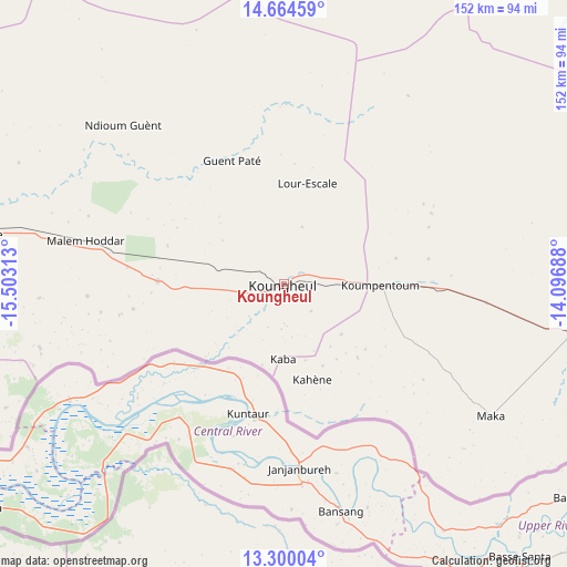
Koungheul GPS coordinates[2]
13° 58' 59.988" North, 14° 48' 0" West
| Map corner | latitude | longitude |
|---|---|---|
| Upper-left | 14.66459°, | -15.50313° |
| Center: | 13.98333°, | -14.8° |
| Lower-right: | 13.30004°, | -14.09688° |
| Map W x H: | 151.7×151.7 km | = 94.3×94.3mi |
| max Lat: | 16.51293° ⇑76.7% North |
| Koungheul: | 13.98333° |
| min Lat: | ⇓23.3% South 12.485° |
| min Long | Koungheul | max Long |
| -17.47581° | -14.8° | -12.18076° |
| W 78.3%⇐ | ⇒21.7% E |
Elevation
Elevation of Koungheul is 17 m = 56 ft, and this is 7.5 m = 25 ft below average elevation for this country.
| Max E: |
127 m = 417 ft | 63.3% |
| Avg. | 24.5 m = 80 ft | |
| Koungheul | 17 m = 56 ft | |
Min E: |
0 m = 0 ft | 36.7% |
See also: Senegal elevation on elevation.city.
Geographical zone
Koungheul is located in North Torrid zone (between Equator and Tropic of Cancer). Distance of this Northern Tropic circle is 1051.1 km =653.1 mi to North.| Distance of | km | miles | from Koungheul |
|---|---|---|---|
| North Pole | 8452.3 | 5252 | to North |
| Arctic Circle | 5846.4 | 3632.8 | to North |
| Tropic Cancer | 1051.1 | 653.1 | to North |
| Equator | 1554.8 | 966.1 | to South |


Nearby cities:
15 places around Koungheul: (largest is in red/bold)
• Dara
168.5 km =104.7 mi,  334°
334°
• Gandiaye
160.6 km =99.8 mi,  279°
279°
• Guinguinéo
127.9 km =79.5 mi, 284°
• Kaffrine
82.1 km =51 mi, 279°
• Kaolack
138.5 km =86.1 mi, 277°
• Kolda
122.1 km =75.9 mi,  187°
187°
• Mbaké
149.3 km =92.8 mi,  306°
306°
• Ndibène Dahra
166.9 km =103.7 mi, 334°
• Ndofane
122.5 km =76.1 mi,  266°
266°
• Nioro du Rip
111 km =69 mi,  256°
256°
• Passi
158.2 km =98.3 mi, 270°
• Sédhiou
163.7 km =101.7 mi,  210°
210°
• Tambacounda
124.5 km =77.4 mi,  100°
100°
• Touba
151.3 km =94 mi, 309°
• Vélingara
118.5 km =73.6 mi,  141°
141°
Sources, notices
• [Note1] Compared only with cities in Senegal existing in our database
• [Src1] Map data: © OpenStreetMap contributors (CC-BY-SA)
• [Src2] Other city data from geonames.org with taken over terms of usage.
• [Src3] Geographical zone / Annual Mean Temperature by Robert A. Rohde @ Wikipedia
