Hobyo geodata
Hobyo (Mudug) is a seat of a second-order administrative division; located in Somalia in Africa/Mogadishu (GMT+3) time zone. With population of 12,564 people, there are 29 cities with bigger population in this country. Compared to other cities in Somalia, 56.6% of cities are located further ↓South; 84.9% of cities are located further ←West and 96.2% of cities have higher elevation than Hobyo. Note1


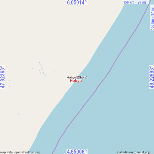
Hobyo GPS coordinates[2]
5° 21' 1.8" North, 48° 31' 36.48" East
| Map corner | latitude | longitude |
|---|---|---|
| Upper-left | 6.05014°, | 47.82368° |
| Center: | 5.3505°, | 48.5268° |
| Lower-right: | 4.65006°, | 49.22993° |
| Map W x H: | 155.7×155.7 km | = 96.7×96.7mi |
| max Lat: | 11.96611° ⇑43.4% North |
| Hobyo: | 5.3505° |
| min Lat: | ⇓56.6% South -1.21917° |
| min Long | Hobyo | max Long |
| 41.83725° | 48.5268° | 51.0773° |
| W 84.9%⇐ | ⇒15.1% E |
Elevation
Elevation of Hobyo is 5 m = 16 ft, and this is 284.9 m = 935 ft below average elevation for this country.
| Max E: |
1786 m = 5860 ft | 96.2% |
| Avg. | 289.9 m = 951 ft | |
| Hobyo | 5 m = 16 ft | |
Min E: |
-2 m = -7 ft | 3.8% |
See also: Somalia elevation on elevation.city.
Geographical zone
Hobyo is located in North Torrid zone (between Equator and Tropic of Cancer). Distance of Equator is 594.9 km =369.7 mi to South.| Distance of | km | miles | from Hobyo |
|---|---|---|---|
| North Pole | 9412.1 | 5848.4 | to North |
| Arctic Circle | 6806.3 | 4229.2 | to North |
| Tropic Cancer | 2011 | 1249.6 | to North |
| Equator | 594.9 | 369.7 | to South |


Nearby cities:
15 places around Hobyo: (largest is in red/bold)
• Adado
227.5 km =141.4 mi,  292°
292°
• Beledweyne
374.4 km =232.6 mi,  259°
259°
• Buulobarde
367.8 km =228.5 mi,  243°
243°
• Cadale
377.8 km =234.8 mi,  220°
220°
• Ceelbuur
224 km =139.2 mi,  250°
250°
• Ceeldheer
223.9 km =139.1 mi, 221°
• Dhuusamarreeb
237.8 km =147.8 mi,  274°
274°
• Eyl
325.2 km =202.1 mi,  25°
25°
• Gaalkacyo
199 km =123.7 mi,  322°
322°
• Garoowe
339.3 km =210.8 mi,  359°
359°
• Jalalaqsi
391.8 km =243.5 mi, 235°
• Jawhar
440.8 km =273.9 mi,  229°
229°
• Laascaanood
370.8 km =230.4 mi,  339°
339°
• Mahaddayweyne
424.3 km =263.6 mi, 231°
• Xarardheere
107.2 km =66.6 mi, 223°
Sources, notices
• [Note1] Compared only with cities in Somalia existing in our database
• [Src1] Map data: © OpenStreetMap contributors (CC-BY-SA)
• [Src2] Other city data from geonames.org with taken over terms of usage.
• [Src3] Geographical zone / Annual Mean Temperature by Robert A. Rohde @ Wikipedia
