Yambio geodata
Yambio (Gbudwe) is a seat of a first-order administrative division; located in South Sudan in Africa/Juba (GMT+2) time zone. With population of 40,382 people, there are 5 cities with bigger population in this country. Compared to other cities in South Sudan, 90.9% of cities are located further ↑North; 75.8% of cities are located further →East and 87.9% of cities have lower elevation than Yambio. Note1


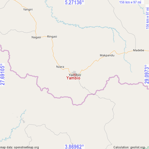
Yambio GPS coordinates[2]
4° 34' 14.988" North, 28° 23' 39.012" East
| Map corner | latitude | longitude |
|---|---|---|
| Upper-left | 5.27136°, | 27.69105° |
| Center: | 4.57083°, | 28.39417° |
| Lower-right: | 3.86962°, | 29.0973° |
| Map W x H: | 155.9×155.9 km | = 96.9×96.9mi |
| max Lat: | 11.7431° ⇑90.9% North |
| Yambio: | 4.57083° |
| min Lat: | ⇓9.1% South 3.86512° |
| min Long | Yambio | max Long |
| 25.67833° | 28.39417° | 33.92621° |
| W 24.2%⇐ | ⇒75.8% E |
Elevation
Elevation of Yambio is 655 m = 2149 ft, and this is 166.1 m = 545 ft above average elevation for this country.
| Max E: |
836 m = 2743 ft | 12.1% |
| Yambio | 655 m 2149 ft | |
| Avg. | 488.9 m = 1604 ft | |
Min E: |
392 m = 1286 ft | 87.9% |
See also: Yambio elevation on elevation.city.
Geographical zone
Yambio is located in North Torrid zone (between Equator and Tropic of Cancer). Distance of Equator is 508.2 km =315.8 mi to South.| Distance of | km | miles | from Yambio |
|---|---|---|---|
| North Pole | 9498.8 | 5902.3 | to North |
| Arctic Circle | 6892.9 | 4283 | to North |
| Tropic Cancer | 2097.7 | 1303.4 | to North |
| Equator | 508.2 | 315.8 | to South |


Nearby cities:
14 places around Yambio: (largest is in red/bold)
• Bor
394.8 km =245.3 mi,  62°
62°
• Cueibet
288.9 km =179.5 mi,  19°
19°
• Gogrial
441.8 km =274.5 mi,  355°
355°
• Juba
354.7 km =220.4 mi,  84°
84°
• Kuacjok
417.5 km =259.4 mi,  353°
353°
• Maridi
125.2 km =77.8 mi,  72°
72°
• Mundri
230.6 km =143.3 mi, 68°
• Rumbek
286.2 km =177.8 mi,  29°
29°
• Tambura
153.8 km =95.6 mi,  318°
318°
• Terekeka
384.3 km =238.8 mi, 75°
• Tonj
302.2 km =187.8 mi,  5°
5°
• Wau
350.9 km =218 mi, 352°
• Yei
258.5 km =160.6 mi,  101°
101°
• Yirol
320.6 km =199.2 mi,  46°
46°
Sources, notices
• [Note1] Compared only with cities in South Sudan existing in our database
• [Src1] Map data: © OpenStreetMap contributors (CC-BY-SA)
• [Src2] Other city data from geonames.org with taken over terms of usage.
• [Src3] Geographical zone / Annual Mean Temperature by Robert A. Rohde @ Wikipedia
