Ntfonjeni geodata
Ntfonjeni (Hhohho) is a seat of a second-order administrative division; located in Eswatini in Africa/Mbabane (GMT+2) time zone. In our database, there are 22 cities with bigger population. Compared to other cities in Eswatini, 100% of cities are located further ↓South; 54.5% of cities are located further →East and 59.1% of cities have higher elevation than Ntfonjeni. Note1


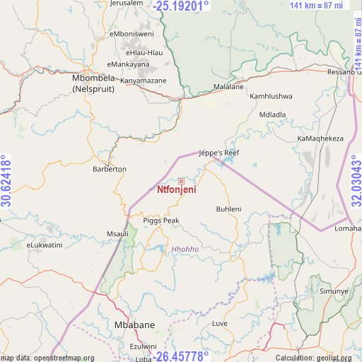
Ntfonjeni GPS coordinates[2]
25° 49' 35.724" South, 31° 19' 38.28" East
| Map corner | latitude | longitude |
|---|---|---|
| Upper-left | -25.19201°, | 30.62418° |
| Center: | -25.82659°, | 31.3273° |
| Lower-right: | -26.45778°, | 32.03043° |
| Map W x H: | 140.7×140.7 km | = 87.4×87.4mi |
| max Lat: | -25.82659° ⇑0% North |
| Ntfonjeni: | -25.82659° |
| min Lat: | ⇓100% South -27.31005° |
| min Long | Ntfonjeni | max Long |
| 31.01667° | 31.3273° | 31.95° |
| W 45.5%⇐ | ⇒54.5% E |
Elevation
Elevation of Ntfonjeni is 552 m = 1811 ft, and this is 126.5 m = 415 ft below average elevation for this country.
| Max E: |
1317 m = 4321 ft | 59.1% |
| Avg. | 678.5 m = 2226 ft | |
| Ntfonjeni | 552 m = 1811 ft | |
Min E: |
109 m = 358 ft | 40.9% |
See also: Eswatini elevation on elevation.city.
Geographical zone
Ntfonjeni is located in South temperate zone (between Tropic of Capricorn and the Antarctic Circle). Distance of this Southern Tropic circle is 265.7 km =165.1 mi to North.| Distance of | km | miles | from Ntfonjeni |
|---|---|---|---|
| Equator | 2871.6 | 1784.3 | to North |
| Tropic Capricorn | 265.7 | 165.1 | to North |
| Antarctic Circle | 4529.5 | 2814.5 | to South |
| South Pole | 7135.4 | 4433.7 | to South |


Nearby cities:
15 places around Ntfonjeni: (largest is in red/bold)
• Bhunya
86.2 km =53.6 mi,  201°
201°
• Bulembu
24.9 km =15.5 mi,  231°
231°
• Darkton
53.9 km =33.5 mi,  213°
213°
• Kwaluseni
73 km =45.4 mi,  179°
179°
• Lobamba
72.3 km =44.9 mi,  190°
190°
• Malkerns
83.5 km =51.9 mi, 189°
• Manzini
74.9 km =46.5 mi, 175°
• Mbabane
57.8 km =35.9 mi, 199°
• Mhlambanyatsi
75.9 km =47.2 mi, 204°
• Mhlume
57.1 km =35.5 mi,  113°
113°
• Piggs Peak
17 km =10.6 mi, 208°
• Sidvokodvo
89.6 km =55.7 mi,  174°
174°
• Siteki
93.1 km =57.8 mi,  138°
138°
• Tshaneni
42.7 km =26.5 mi, 114°
• Vuvulane
61.4 km =38.2 mi,  116°
116°
Sources, notices
• [Note1] Compared only with cities in Eswatini existing in our database
• [Src1] Map data: © OpenStreetMap contributors (CC-BY-SA)
• [Src2] Other city data from geonames.org with taken over terms of usage.
• [Src3] Geographical zone / Annual Mean Temperature by Robert A. Rohde @ Wikipedia
