Tshaneni geodata
Tshaneni (Lubombo) is a populated place; located in Eswatini in Africa/Mbabane (GMT+2) time zone. With population of 1,899 people, there are 18 cities with bigger population in this country. Compared to other cities in Eswatini, 86.4% of cities are located further ↓South; 72.7% of cities are located further ←West and 77.3% of cities have higher elevation than Tshaneni. Note1


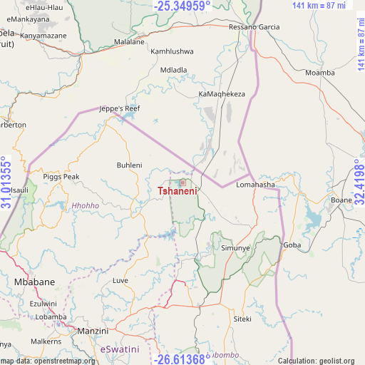
Tshaneni GPS coordinates[2]
25° 58' 59.988" South, 31° 43' 0.012" East
| Map corner | latitude | longitude |
|---|---|---|
| Upper-left | -25.34959°, | 31.01355° |
| Center: | -25.98333°, | 31.71667° |
| Lower-right: | -26.61368°, | 32.4198° |
| Map W x H: | 140.6×140.6 km | = 87.4×87.4mi |
| max Lat: | -25.82659° ⇑13.6% North |
| Tshaneni: | -25.98333° |
| min Lat: | ⇓86.4% South -27.31005° |
| min Long | Tshaneni | max Long |
| 31.01667° | 31.71667° | 31.95° |
| W 72.7%⇐ | ⇒27.3% E |
Elevation
Elevation of Tshaneni is 292 m = 958 ft, and this is 386.5 m = 1268 ft below average elevation for this country.
| Max E: |
1317 m = 4321 ft | 77.3% |
| Avg. | 678.5 m = 2226 ft | |
| Tshaneni | 292 m = 958 ft | |
Min E: |
109 m = 358 ft | 22.7% |
See also: Eswatini elevation on elevation.city.
Geographical zone
Tshaneni is located in South temperate zone (between Tropic of Capricorn and the Antarctic Circle). Distance of this Southern Tropic circle is 283.2 km =176 mi to North.| Distance of | km | miles | from Tshaneni |
|---|---|---|---|
| Equator | 2889.1 | 1795.2 | to North |
| Tropic Capricorn | 283.2 | 176 | to North |
| Antarctic Circle | 4512.1 | 2803.7 | to South |
| South Pole | 7118 | 4422.9 | to South |


Nearby cities:
15 places around Tshaneni: (largest is in red/bold)
• Bhunya
94 km =58.4 mi,  227°
227°
• Bulembu
58.3 km =36.2 mi,  271°
271°
• Darkton
73.7 km =45.8 mi,  247°
247°
• Kwaluseni
67.5 km =41.9 mi,  214°
214°
• Lobamba
74.5 km =46.3 mi,  223°
223°
• Malkerns
83.9 km =52.1 mi, 219°
• Manzini
66.4 km =41.3 mi, 210°
• Mbabane
69 km =42.9 mi,  237°
237°
• Mhlambanyatsi
87 km =54.1 mi, 233°
• Mhlume
14.4 km =8.9 mi,  112°
112°
• Ntfonjeni
42.7 km =26.5 mi,  294°
294°
• Piggs Peak
47 km =29.2 mi, 273°
• Sidvokodvo
77.6 km =48.2 mi,  202°
202°
• Siteki
57 km =35.4 mi,  156°
156°
• Vuvulane
18.9 km =11.7 mi,  122°
122°
Sources, notices
• [Note1] Compared only with cities in Eswatini existing in our database
• [Src1] Map data: © OpenStreetMap contributors (CC-BY-SA)
• [Src2] Other city data from geonames.org with taken over terms of usage.
• [Src3] Geographical zone / Annual Mean Temperature by Robert A. Rohde @ Wikipedia
