Shŭrob geodata
Shŭrob (Sughd) is a populated place; located in Tajikistan in Asia/Dushanbe (GMT+5) time zone. With population of 3,984 people, there are 53 cities with bigger population in this country. Compared to other cities in Tajikistan, 77.3% of cities are located further ↓South; 85.2% of cities are located further ←West and 68.2% of cities have lower elevation than Shŭrob. Note1


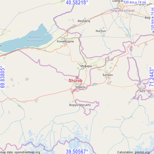
Shŭrob GPS coordinates[2]
40° 2' 45.78" North, 70° 32' 28.212" East
| Map corner | latitude | longitude |
|---|---|---|
| Upper-left | 40.58218°, | 69.83805° |
| Center: | 40.04605°, | 70.54117° |
| Lower-right: | 39.50567°, | 71.2443° |
| Map W x H: | 119.7×119.7 km | = 74.4×74.4mi |
| max Lat: | 40.99827° ⇑22.7% North |
| Shŭrob: | 40.04605° |
| min Lat: | ⇓77.3% South 36.72484° |
| min Long | Shŭrob | max Long |
| 67.60931° | 70.54117° | 73.96674° |
| W 85.2%⇐ | ⇒14.8% E |
Elevation
Elevation of Shŭrob is 1248 m = 4094 ft, and this is 285.5 m = 937 ft above average elevation for this country.
| Max E: |
3607 m = 11834 ft | 31.8% |
| Shŭrob | 1248 m 4094 ft | |
| Avg. | 962.5 m = 3158 ft | |
Min E: |
324 m = 1063 ft | 68.2% |
See also: Tajikistan elevation on elevation.city.
Geographical zone
Shŭrob is located in North temperate zone (between Tropic of Cancer and the Arctic Circle). Distance of this Northern Tropic circle is 1846.8 km =1147.5 mi to South.| Distance of | km | miles | from Shŭrob |
|---|---|---|---|
| North Pole | 5554.4 | 3451.3 | to North |
| Arctic Circle | 2948.5 | 1832.1 | to North |
| Tropic Cancer | 1846.8 | 1147.5 | to South |
| Equator | 4452.7 | 2766.8 | to South |


Nearby cities:
15 places around Shŭrob: (largest is in red/bold)
• Adrasmon
82 km =51 mi,  324°
324°
• Chkalov
74.9 km =46.5 mi,  286°
286°
• Ghafurov
71.6 km =44.5 mi, 285°
• Isfara
11.5 km =7.1 mi,  38°
38°
• Khŭjand
82.4 km =51.2 mi, 288°
• Kim
19 km =11.8 mi,  341°
341°
• Konibodom
29.1 km =18.1 mi, 341°
• Konsoy
86.7 km =53.9 mi,  304°
304°
• Neftobod
19 km =11.8 mi,  7°
7°
• Nov
100.2 km =62.3 mi,  276°
276°
• Palos
74.6 km =46.4 mi, 293°
• Proletar
89.4 km =55.6 mi, 278°
• Shaydon
71.2 km =44.2 mi,  346°
346°
• Taboshar
96 km =59.7 mi,  307°
307°
• Vorukh
21.9 km =13.6 mi,  171°
171°
Sources, notices
• [Note1] Compared only with cities in Tajikistan existing in our database
• [Src1] Map data: © OpenStreetMap contributors (CC-BY-SA)
• [Src2] Other city data from geonames.org with taken over terms of usage.
• [Src3] Geographical zone / Annual Mean Temperature by Robert A. Rohde @ Wikipedia
