Kim geodata
Kim (Sughd) is a populated place; located in Tajikistan in Asia/Dushanbe (GMT+5) time zone. With population of 2,411 people, there are 59 cities with bigger population in this country. Compared to other cities in Tajikistan, 84.1% of cities are located further ↓South; 83% of cities are located further ←West and 55.7% of cities have lower elevation than Kim. Note1


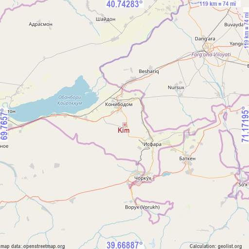
Kim GPS coordinates[2]
40° 12' 28.728" North, 70° 28' 7.752" East
| Map corner | latitude | longitude |
|---|---|---|
| Upper-left | 40.74283°, | 69.7657° |
| Center: | 40.20798°, | 70.46882° |
| Lower-right: | 39.66887°, | 71.17195° |
| Map W x H: | 119.4×119.4 km | = 74.2×74.2mi |
| max Lat: | 40.99827° ⇑15.9% North |
| Kim: | 40.20798° |
| min Lat: | ⇓84.1% South 36.72484° |
| min Long | Kim | max Long |
| 67.60931° | 70.46882° | 73.96674° |
| W 83%⇐ | ⇒17% E |
Elevation
Elevation of Kim is 864 m = 2835 ft, and this is 98.5 m = 323 ft below average elevation for this country.
| Max E: |
3607 m = 11834 ft | 44.3% |
| Avg. | 962.5 m = 3158 ft | |
| Kim | 864 m = 2835 ft | |
Min E: |
324 m = 1063 ft | 55.7% |
See also: Tajikistan elevation on elevation.city.
Geographical zone
Kim is located in North temperate zone (between Tropic of Cancer and the Arctic Circle). Distance of this Northern Tropic circle is 1864.8 km =1158.7 mi to South.| Distance of | km | miles | from Kim |
|---|---|---|---|
| North Pole | 5536.4 | 3440.2 | to North |
| Arctic Circle | 2930.5 | 1820.9 | to North |
| Tropic Cancer | 1864.8 | 1158.7 | to South |
| Equator | 4470.7 | 2778 | to South |


Nearby cities:
15 places around Kim: (largest is in red/bold)
• Adrasmon
63.9 km =39.7 mi,  320°
320°
• Chkalov
65.8 km =40.9 mi,  272°
272°
• Ghafurov
62.9 km =39.1 mi, 270°
• Isfara
16.1 km =10 mi,  124°
124°
• Khŭjand
72.3 km =44.9 mi,  276°
276°
• Konibodom
10.1 km =6.3 mi,  341°
341°
• Konsoy
72.2 km =44.9 mi,  295°
295°
• Navgarzan
87.9 km =54.6 mi,  357°
357°
• Neftobod
8.8 km =5.5 mi,  84°
84°
• Palos
63.2 km =39.3 mi, 280°
• Proletar
82.3 km =51.1 mi, 266°
• Shaydon
52.3 km =32.5 mi,  348°
348°
• Shŭrob
19 km =11.8 mi,  161°
161°
• Taboshar
80.8 km =50.2 mi, 299°
• Vorukh
40.8 km =25.4 mi,  166°
166°
Sources, notices
• [Note1] Compared only with cities in Tajikistan existing in our database
• [Src1] Map data: © OpenStreetMap contributors (CC-BY-SA)
• [Src2] Other city data from geonames.org with taken over terms of usage.
• [Src3] Geographical zone / Annual Mean Temperature by Robert A. Rohde @ Wikipedia
