Midoun geodata
Midoun (Madanīn) is a seat of a second-order administrative division; located in Tunisia in Africa/Tunis (GMT+1) time zone. With population of 32,000 people, there are 44 cities with bigger population in this country. Compared to other cities in Tunisia, 92.3% of cities are located further ↑North; 92.3% of cities are located further ←West and 75.5% of cities have higher elevation than Midoun. Note1


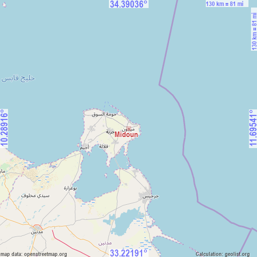
Midoun GPS coordinates[2]
33° 48' 29.268" North, 10° 59' 32.208" East
| Map corner | latitude | longitude |
|---|---|---|
| Upper-left | 34.39036°, | 10.28916° |
| Center: | 33.80813°, | 10.99228° |
| Lower-right: | 33.22191°, | 11.69541° |
| Map W x H: | 129.9×129.9 km | = 80.7×80.7mi |
| max Lat: | 37.27442° ⇑92.3% North |
| Midoun: | 33.80813° |
| min Lat: | ⇓7.7% South 32.31662° |
| min Long | Midoun | max Long |
| 7.87765° | 10.99228° | 11.21965° |
| W 92.3%⇐ | ⇒7.7% E |
Elevation
Elevation of Midoun is 15 m = 49 ft, and this is 134.4 m = 441 ft below average elevation for this country.
| Max E: |
999 m = 3278 ft | 75.5% |
| Avg. | 149.4 m = 490 ft | |
| Midoun | 15 m = 49 ft | |
Min E: |
-6 m = -20 ft | 24.5% |
See also: Tunisia elevation on elevation.city.
Geographical zone
Midoun is located in North temperate zone (between Tropic of Cancer and the Arctic Circle). Distance of this Northern Tropic circle is 1153.2 km =716.6 mi to South.| Distance of | km | miles | from Midoun |
|---|---|---|---|
| North Pole | 6248 | 3882.3 | to North |
| Arctic Circle | 3642.1 | 2263.1 | to North |
| Tropic Cancer | 1153.2 | 716.6 | to South |
| Equator | 3759.1 | 2335.8 | to South |


Nearby cities:
15 places around Midoun: (largest is in red/bold)
• Ben Gardane
77.5 km =48.2 mi,  164°
164°
• Beni Kheddache
96 km =59.7 mi,  229°
229°
• Bir Ali Ben Khalifa
132.2 km =82.1 mi,  321°
321°
• Bou Attouche
111.9 km =69.5 mi,  275°
275°
• El Hamma
110.8 km =68.8 mi,  274°
274°
• Erriadh
12.9 km =8 mi, 276°
• Gabès
83 km =51.6 mi, 275°
• Gremda
106.5 km =66.2 mi,  349°
349°
• Houmt El Souk
14.5 km =9 mi,  301°
301°
• Matmata
98.9 km =61.5 mi,  252°
252°
• Medenine
67.6 km =42 mi,  221°
221°
• Sfax
105.8 km =65.7 mi, 348°
• Skhira
101 km =62.8 mi, 302°
• Tataouine
109.8 km =68.2 mi,  207°
207°
• Zarzis
35.6 km =22.1 mi, 161°
Sources, notices
• [Note1] Compared only with cities in Tunisia existing in our database
• [Src1] Map data: © OpenStreetMap contributors (CC-BY-SA)
• [Src2] Other city data from geonames.org with taken over terms of usage.
• [Src3] Geographical zone / Annual Mean Temperature by Robert A. Rohde @ Wikipedia
