Ben Gardane geodata
Ben Gardane (Madanīn) is a populated place; located in Tunisia in Africa/Tunis (GMT+1) time zone. With population of 13,364 people, there are 78 cities with bigger population in this country. Compared to other cities in Tunisia, 98.6% of cities are located further ↑North; 100% of cities are located further ←West and 78.3% of cities have higher elevation than Ben Gardane. Note1


Ben Gardane GPS coordinates[2]
33° 8' 16.188" North, 11° 13' 10.74" East
| Map corner | latitude | longitude |
|---|---|---|
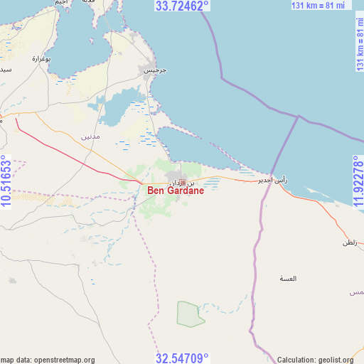
| Upper-left | 33.72462°, | 10.51653° |
| Center: | 33.13783°, | 11.21965° |
| Lower-right: | 32.54709°, | 11.92278° |
| Map W x H: | 130.9×130.9 km | = 81.3×81.3mi |
| max Lat: | 37.27442° ⇑98.6% North |
| Ben Gardane: | 33.13783° |
| min Lat: | ⇓1.4% South 32.31662° |
| min Long | Ben Gardane | max Long |
| 7.87765° | 11.21965° | 11.21965° |
| W 100%⇐ | ⇒0% E |
Elevation
Elevation of Ben Gardane is 13 m = 43 ft, and this is 136.4 m = 448 ft below average elevation for this country.
| Max E: |
999 m = 3278 ft | 78.3% |
| Avg. | 149.4 m = 490 ft | |
| Ben Gardane | 13 m = 43 ft | |
Min E: |
-6 m = -20 ft | 21.7% |
See also: Tunisia elevation on elevation.city.
Geographical zone
Ben Gardane is located in North temperate zone (between Tropic of Cancer and the Arctic Circle). Distance of this Northern Tropic circle is 1078.7 km =670.3 mi to South.| Distance of | km | miles | from Ben Gardane |
|---|---|---|---|
| North Pole | 6322.5 | 3928.6 | to North |
| Arctic Circle | 3716.6 | 2309.4 | to North |
| Tropic Cancer | 1078.7 | 670.3 | to South |
| Equator | 3684.6 | 2289.5 | to South |


Nearby cities:
15 places around Ben Gardane: (largest is in red/bold)
• Beni Kheddache
95.8 km =59.5 mi,  277°
277°
• Bou Attouche
157.7 km =98 mi,  302°
302°
• El Hamma
156.3 km =97.1 mi, 302°
• Erriadh
83.2 km =51.7 mi,  335°
335°
• Gabès
132.8 km =82.5 mi,  308°
308°
• Gremda
183.7 km =114.1 mi,  347°
347°
• Houmt El Souk
88.7 km =55.1 mi, 337°
• Matmata
124.4 km =77.3 mi,  291°
291°
• Medenine
70.7 km =43.9 mi, 289°
• Midoun
77.5 km =48.2 mi, 344°
• Remada
119.5 km =74.3 mi,  220°
220°
• Sfax
183.2 km =113.8 mi, 346°
• Skhira
167.3 km =104 mi,  320°
320°
• Tataouine
75.2 km =46.7 mi,  252°
252°
• Zarzis
41.9 km =26 mi, 346°
Sources, notices
• [Note1] Compared only with cities in Tunisia existing in our database
• [Src1] Map data: © OpenStreetMap contributors (CC-BY-SA)
• [Src2] Other city data from geonames.org with taken over terms of usage.
• [Src3] Geographical zone / Annual Mean Temperature by Robert A. Rohde @ Wikipedia
