Mwandiga geodata
Mwandiga (Kigoma) is a populated place; located in Tanzania in Africa/Dar_es_Salaam (GMT+3) time zone. With population of 16,822 people, there are 167 cities with bigger population in this country. Compared to other cities in Tanzania, 58% of cities are located further ↓South; 99.7% of cities are located further →East and 61.9% of cities have higher elevation than Mwandiga. Note1


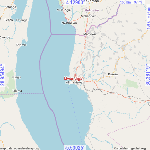
Mwandiga GPS coordinates[2]
4° 49' 48" South, 29° 39' 29.016" East
| Map corner | latitude | longitude |
|---|---|---|
| Upper-left | -4.12903°, | 28.95494° |
| Center: | -4.83°, | 29.65806° |
| Lower-right: | -5.53025°, | 30.36119° |
| Map W x H: | 155.8×155.8 km | = 96.8×96.8mi |
| max Lat: | -1.14389° ⇑42% North |
| Mwandiga: | -4.83° |
| min Lat: | ⇓58% South -11.36667° |
| min Long | Mwandiga | max Long |
| 29.62667° | 29.65806° | 40.33333° |
| W 0.3%⇐ | ⇒99.7% E |
Elevation
Elevation of Mwandiga is 871 m = 2858 ft, and this is 71.8 m = 236 ft below average elevation for this country.
| Max E: |
2377 m = 7799 ft | 61.9% |
| Avg. | 942.8 m = 3093 ft | |
| Mwandiga | 871 m = 2858 ft | |
Min E: |
0 m = 0 ft | 38.1% |
See also: Tanzania elevation on elevation.city.
Geographical zone
Mwandiga is located in South Torrid zone (between Equator and Tropic of Capricorn). Distance of Equator is 537 km =333.7 mi to North.| Distance of | km | miles | from Mwandiga |
|---|---|---|---|
| Equator | 537 | 333.7 | to North |
| Tropic Capricorn | 2068.9 | 1285.6 | to South |
| Antarctic Circle | 6864.1 | 4265.2 | to South |
| South Pole | 9470 | 5884.4 | to South |


Nearby cities:
15 places around Mwandiga: (largest is in red/bold)
• Bugarama
238.3 km =148.1 mi,  23°
23°
• Kabanga
259.7 km =161.4 mi, 20°
• Kakonko
224.9 km =139.7 mi,  40°
40°
• Kaliua
238 km =147.9 mi,  96°
96°
• Karema
237.6 km =147.6 mi,  158°
158°
• Kasulu
56.7 km =35.2 mi,  60°
60°
• Kibondo
181.6 km =112.8 mi, 40°
• Kigoma
6.3 km =3.9 mi,  213°
213°
• Mabamba
165.9 km =103.1 mi,  34°
34°
• Mpanda
229.6 km =142.7 mi,  137°
137°
• Nguruka
156.4 km =97.2 mi, 101°
• Rulenge
258.6 km =160.7 mi, 24°
• Urambo
266.3 km =165.5 mi, 95°
• Uvinza
86.7 km =53.9 mi,  110°
110°
• Uyovu
269.2 km =167.3 mi,  50°
50°
Sources, notices
• [Note1] Compared only with cities in Tanzania existing in our database
• [Src1] Map data: © OpenStreetMap contributors (CC-BY-SA)
• [Src2] Other city data from geonames.org with taken over terms of usage.
• [Src3] Geographical zone / Annual Mean Temperature by Robert A. Rohde @ Wikipedia
