Karema geodata
Karema (Katavi) is a populated place; located in Tanzania in Africa/Dar_es_Salaam (GMT+3) time zone. With population of 12,630 people, there are 204 cities with bigger population in this country. Compared to other cities in Tanzania, 65.4% of cities are located further ↑North; 98.6% of cities are located further →East and 63.6% of cities have higher elevation than Karema. Note1


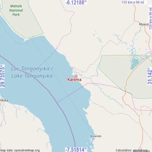
Karema GPS coordinates[2]
6° 49' 13.872" South, 30° 26' 19.932" East
| Map corner | latitude | longitude |
|---|---|---|
| Upper-left | -6.12188°, | 29.73575° |
| Center: | -6.82052°, | 30.43887° |
| Lower-right: | -7.51814°, | 31.142° |
| Map W x H: | 155.2×155.3 km | = 96.4×96.5mi |
| max Lat: | -1.14389° ⇑65.4% North |
| Karema: | -6.82052° |
| min Lat: | ⇓34.6% South -11.36667° |
| min Long | Karema | max Long |
| 29.62667° | 30.43887° | 40.33333° |
| W 1.4%⇐ | ⇒98.6% E |
Elevation
Elevation of Karema is 777 m = 2549 ft, and this is 165.8 m = 544 ft below average elevation for this country.
| Max E: |
2377 m = 7799 ft | 63.6% |
| Avg. | 942.8 m = 3093 ft | |
| Karema | 777 m = 2549 ft | |
Min E: |
0 m = 0 ft | 36.4% |
See also: Tanzania elevation on elevation.city.
Geographical zone
Karema is located in South Torrid zone (between Equator and Tropic of Capricorn). Distance of Equator is 758.4 km =471.2 mi to North.| Distance of | km | miles | from Karema |
|---|---|---|---|
| Equator | 758.4 | 471.2 | to North |
| Tropic Capricorn | 1847.5 | 1148 | to South |
| Antarctic Circle | 6642.8 | 4127.6 | to South |
| South Pole | 9248.7 | 5746.9 | to South |


Nearby cities:
15 places around Karema: (largest is in red/bold)
• Chala
124.6 km =77.4 mi,  132°
132°
• Inyonga
180.1 km =111.9 mi,  86°
86°
• Kaliua
246.5 km =153.2 mi,  37°
37°
• Kasulu
252.3 km =156.8 mi,  351°
351°
• Kigoma
234 km =145.4 mi,  337°
337°
• Kirando
68.6 km =42.6 mi,  164°
164°
• Matai
202.9 km =126.1 mi,  144°
144°
• Mpanda
87.5 km =54.4 mi,  52°
52°
• Mwandiga
237.6 km =147.6 mi, 338°
• Namanyere
102.6 km =63.8 mi, 138°
• Nguruka
201.6 km =125.3 mi,  19°
19°
• Nkove
133.5 km =83 mi, 160°
• Sumbawanga
182 km =113.1 mi, 134°
• Usevia
93 km =57.8 mi,  109°
109°
• Uvinza
191 km =118.7 mi,  358°
358°
Sources, notices
• [Note1] Compared only with cities in Tanzania existing in our database
• [Src1] Map data: © OpenStreetMap contributors (CC-BY-SA)
• [Src2] Other city data from geonames.org with taken over terms of usage.
• [Src3] Geographical zone / Annual Mean Temperature by Robert A. Rohde @ Wikipedia
