Kasulu geodata
Kasulu (Kigoma) is a populated place; located in Tanzania in Africa/Dar_es_Salaam (GMT+3) time zone. With population of 37,349 people, there are 39 cities with bigger population in this country. Compared to other cities in Tanzania, 61.5% of cities are located further ↓South; 99.3% of cities are located further →East and 72% of cities have lower elevation than Kasulu. Note1


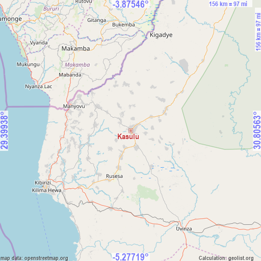
Kasulu GPS coordinates[2]
4° 34' 36.012" South, 30° 6' 9" East
| Map corner | latitude | longitude |
|---|---|---|
| Upper-left | -3.87546°, | 29.39938° |
| Center: | -4.57667°, | 30.1025° |
| Lower-right: | -5.27719°, | 30.80563° |
| Map W x H: | 155.9×155.9 km | = 96.9×96.9mi |
| max Lat: | -1.14389° ⇑38.5% North |
| Kasulu: | -4.57667° |
| min Lat: | ⇓61.5% South -11.36667° |
| min Long | Kasulu | max Long |
| 29.62667° | 30.1025° | 40.33333° |
| W 0.7%⇐ | ⇒99.3% E |
Elevation
Elevation of Kasulu is 1310 m = 4298 ft, and this is 367.2 m = 1205 ft above average elevation for this country.
| Max E: |
2377 m = 7799 ft | 28% |
| Kasulu | 1310 m 4298 ft | |
| Avg. | 942.8 m = 3093 ft | |
Min E: |
0 m = 0 ft | 72% |
See also: Tanzania elevation on elevation.city.
Geographical zone
Kasulu is located in South Torrid zone (between Equator and Tropic of Capricorn). Distance of Equator is 508.9 km =316.2 mi to North.| Distance of | km | miles | from Kasulu |
|---|---|---|---|
| Equator | 508.9 | 316.2 | to North |
| Tropic Capricorn | 2097 | 1303 | to South |
| Antarctic Circle | 6892.3 | 4282.7 | to South |
| South Pole | 9498.2 | 5901.9 | to South |


Nearby cities:
15 places around Kasulu: (largest is in red/bold)
• Bugarama
195.5 km =121.5 mi,  13°
13°
• Kabanga
219.3 km =136.3 mi, 10°
• Kakonko
172.7 km =107.3 mi,  33°
33°
• Kaliua
194.9 km =121.1 mi,  106°
106°
• Kibondo
129.7 km =80.6 mi, 31°
• Kigoma
62.4 km =38.8 mi,  237°
237°
• Mabamba
117.5 km =73 mi,  22°
22°
• Mpanda
223.7 km =139 mi,  151°
151°
• Mwandiga
56.7 km =35.2 mi, 240°
• Ngara
237.6 km =147.6 mi, 14°
• Nguruka
119.7 km =74.4 mi,  119°
119°
• Rulenge
214.9 km =133.5 mi, 15°
• Urambo
222.5 km =138.3 mi,  104°
104°
• Uvinza
66.7 km =41.4 mi, 151°
• Uyovu
213.6 km =132.7 mi,  47°
47°
Sources, notices
• [Note1] Compared only with cities in Tanzania existing in our database
• [Src1] Map data: © OpenStreetMap contributors (CC-BY-SA)
• [Src2] Other city data from geonames.org with taken over terms of usage.
• [Src3] Geographical zone / Annual Mean Temperature by Robert A. Rohde @ Wikipedia
