Mabamba geodata
Mabamba (Kigoma) is a populated place; located in Tanzania in Africa/Dar_es_Salaam (GMT+3) time zone. With population of 14,140 people, there are 190 cities with bigger population in this country. Compared to other cities in Tanzania, 74.5% of cities are located further ↓South; 97.9% of cities are located further →East and 71% of cities have lower elevation than Mabamba. Note1


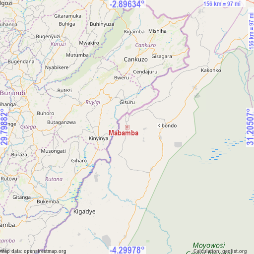
Mabamba GPS coordinates[2]
3° 35' 53.988" South, 30° 30' 6.984" East
| Map corner | latitude | longitude |
|---|---|---|
| Upper-left | -2.89634°, | 29.79882° |
| Center: | -3.59833°, | 30.50194° |
| Lower-right: | -4.29978°, | 31.20507° |
| Map W x H: | 156×156.1 km | = 96.9×97mi |
| max Lat: | -1.14389° ⇑25.5% North |
| Mabamba: | -3.59833° |
| min Lat: | ⇓74.5% South -11.36667° |
| min Long | Mabamba | max Long |
| 29.62667° | 30.50194° | 40.33333° |
| W 2.1%⇐ | ⇒97.9% E |
Elevation
Elevation of Mabamba is 1297 m = 4255 ft, and this is 354.2 m = 1162 ft above average elevation for this country.
| Max E: |
2377 m = 7799 ft | 29% |
| Mabamba | 1297 m 4255 ft | |
| Avg. | 942.8 m = 3093 ft | |
Min E: |
0 m = 0 ft | 71% |
See also: Tanzania elevation on elevation.city.
Geographical zone
Mabamba is located in South Torrid zone (between Equator and Tropic of Capricorn). Distance of Equator is 400.1 km =248.6 mi to North.| Distance of | km | miles | from Mabamba |
|---|---|---|---|
| Equator | 400.1 | 248.6 | to North |
| Tropic Capricorn | 2205.8 | 1370.6 | to South |
| Antarctic Circle | 7001.1 | 4350.3 | to South |
| South Pole | 9607 | 5969.5 | to South |


Nearby cities:
15 places around Mabamba: (largest is in red/bold)
• Biharamulo
139.9 km =86.9 mi,  39°
39°
• Bugarama
81 km =50.3 mi,  2°
2°
• Buseresere
165.2 km =102.7 mi,  67°
67°
• Kabanga
106.8 km =66.4 mi,  357°
357°
• Kakonko
62.2 km =38.6 mi,  55°
55°
• Kasulu
117.5 km =73 mi,  202°
202°
• Katoro
167.5 km =104.1 mi, 67°
• Kibondo
24.3 km =15.1 mi,  86°
86°
• Kigoma
172.1 km =106.9 mi,  214°
214°
• Mwandiga
165.9 km =103.1 mi, 214°
• Ngara
122 km =75.8 mi,  8°
8°
• Rulenge
99 km =61.5 mi, 8°
• Ushirombo
162.7 km =101.1 mi, 85°
• Uvinza
167.8 km =104.3 mi,  184°
184°
• Uyovu
118.9 km =73.9 mi, 72°
Sources, notices
• [Note1] Compared only with cities in Tanzania existing in our database
• [Src1] Map data: © OpenStreetMap contributors (CC-BY-SA)
• [Src2] Other city data from geonames.org with taken over terms of usage.
• [Src3] Geographical zone / Annual Mean Temperature by Robert A. Rohde @ Wikipedia
