Bugarama geodata
Bugarama (Kagera) is a populated place; located in Tanzania in Africa/Dar_es_Salaam (GMT+3) time zone. With population of 32,494 people, there are 57 cities with bigger population in this country. Compared to other cities in Tanzania, 85.7% of cities are located further ↓South; 97.6% of cities are located further →East and 82.9% of cities have lower elevation than Bugarama. Note1


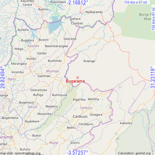
Bugarama GPS coordinates[2]
2° 52' 14.016" South, 30° 31' 41.016" East
| Map corner | latitude | longitude |
|---|---|---|
| Upper-left | -2.16812°, | 29.82494° |
| Center: | -2.87056°, | 30.52806° |
| Lower-right: | -3.57257°, | 31.23119° |
| Map W x H: | 156.2×156.2 km | = 97.1×97.1mi |
| max Lat: | -1.14389° ⇑14.3% North |
| Bugarama: | -2.87056° |
| min Lat: | ⇓85.7% South -11.36667° |
| min Long | Bugarama | max Long |
| 29.62667° | 30.52806° | 40.33333° |
| W 2.4%⇐ | ⇒97.6% E |
Elevation
Elevation of Bugarama is 1493 m = 4898 ft, and this is 550.2 m = 1805 ft above average elevation for this country.
| Max E: |
2377 m = 7799 ft | 17.1% |
| Bugarama | 1493 m 4898 ft | |
| Avg. | 942.8 m = 3093 ft | |
Min E: |
0 m = 0 ft | 82.9% |
See also: Tanzania elevation on elevation.city.
Geographical zone
Bugarama is located in South Torrid zone (between Equator and Tropic of Capricorn). Distance of Equator is 319.2 km =198.3 mi to North.| Distance of | km | miles | from Bugarama |
|---|---|---|---|
| Equator | 319.2 | 198.3 | to North |
| Tropic Capricorn | 2286.7 | 1420.9 | to South |
| Antarctic Circle | 7082 | 4400.5 | to South |
| South Pole | 9687.9 | 6019.8 | to South |


Nearby cities:
15 places around Bugarama: (largest is in red/bold)
• Biharamulo
90.7 km =56.4 mi,  72°
72°
• Bugene
157.7 km =98 mi,  25°
25°
• Buseresere
150.5 km =93.5 mi,  96°
96°
• Chato
140 km =87 mi,  79°
79°
• Kabanga
26.6 km =16.5 mi,  345°
345°
• Kakonko
66.7 km =41.4 mi,  133°
133°
• Katoro
152.8 km =94.9 mi, 96°
• Kibondo
82.4 km =51.2 mi,  164°
164°
• Mabamba
81 km =50.3 mi,  182°
182°
• Muleba
169.7 km =105.4 mi,  47°
47°
• Ngara
42.3 km =26.3 mi,  19°
19°
• Nshamba
164.7 km =102.3 mi,  43°
43°
• Nyakahanga
156.5 km =97.2 mi, 25°
• Rulenge
20.6 km =12.8 mi, 34°
• Uyovu
119.9 km =74.5 mi,  112°
112°
Sources, notices
• [Note1] Compared only with cities in Tanzania existing in our database
• [Src1] Map data: © OpenStreetMap contributors (CC-BY-SA)
• [Src2] Other city data from geonames.org with taken over terms of usage.
• [Src3] Geographical zone / Annual Mean Temperature by Robert A. Rohde @ Wikipedia
