Obodivka geodata
Obodivka (Vinnyts'ka) is a populated place; located in Ukraine in Europe/Kiev (GMT+3) time zone. With population of 3,378 people, there are 851 cities with bigger population in this country. Compared to other cities in Ukraine, 53% of cities are located further ↓South; 71.3% of cities are located further →East and 64.9% of cities have lower elevation than Obodivka. Note1


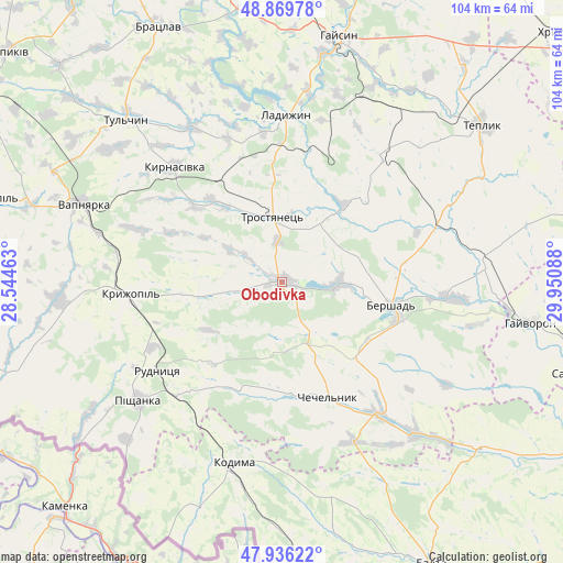
Obodivka GPS coordinates[2]
48° 24' 18.504" North, 29° 14' 51.9" East
| Map corner | latitude | longitude |
|---|---|---|
| Upper-left | 48.86978°, | 28.54463° |
| Center: | 48.40514°, | 29.24775° |
| Lower-right: | 47.93622°, | 29.95088° |
| Map W x H: | 103.8×103.8 km | = 64.5×64.5mi |
| max Lat: | 52.18903° ⇑47% North |
| Obodivka: | 48.40514° |
| min Lat: | ⇓53% South 44.39214° |
| min Long | Obodivka | max Long |
| 22.20555° | 29.24775° | 40.13222° |
| W 28.7%⇐ | ⇒71.3% E |
Elevation
Elevation of Obodivka is 185 m = 607 ft, and this is 29.2 m = 96 ft above average elevation for this country.
| Max E: |
886 m = 2907 ft | 35.1% |
| Obodivka | 185 m 607 ft | |
| Avg. | 155.8 m = 511 ft | |
Min E: |
-3 m = -10 ft | 64.9% |
See also: Ukraine elevation on elevation.city.
Geographical zone
Obodivka is located in North temperate zone (between Tropic of Cancer and the Arctic Circle). Distance of this North polar circle is 2019 km =1254.5 mi to North.| Distance of | km | miles | from Obodivka |
|---|---|---|---|
| North Pole | 4624.9 | 2873.8 | to North |
| Arctic Circle | 2019 | 1254.5 | to North |
| Tropic Cancer | 2776.2 | 1725.1 | to South |
| Equator | 5382.1 | 3344.3 | to South |


Nearby cities:
15 places around Obodivka: (largest is in red/bold)
• Bershad
20.3 km =12.6 mi,  101°
101°
• Chechelnyk
22.9 km =14.2 mi,  157°
157°
• Haisyn
46.4 km =28.8 mi,  13°
13°
• Hayvoron
46.4 km =28.8 mi, 99°
• Kodyma
35.3 km =21.9 mi,  194°
194°
• Kryzhopil’
28.3 km =17.6 mi,  264°
264°
• Ladyzhyn
31.1 km =19.3 mi,  358°
358°
• Pishchanka
34.6 km =21.5 mi,  230°
230°
• Teplyk
46.7 km =29 mi,  51°
51°
• Torkanivka
11.6 km =7.2 mi,  219°
219°
• Trostyanets’
11.7 km =7.3 mi, 355°
• Tsybulevka
10.9 km =6.8 mi, 259°
• Tulchyn
42.1 km =26.2 mi,  315°
315°
• Vapnyarka
39.9 km =24.8 mi,  291°
291°
• Viytivka
21.9 km =13.6 mi,  83°
83°
Sources, notices
• [Note1] Compared only with cities in Ukraine existing in our database
• [Src1] Map data: © OpenStreetMap contributors (CC-BY-SA)
• [Src2] Other city data from geonames.org with taken over terms of usage.
• [Src3] Geographical zone / Annual Mean Temperature by Robert A. Rohde @ Wikipedia
