Viytivka geodata
Viytivka (Vinnyts'ka) is a populated place; located in Ukraine in Europe/Kiev (GMT+3) time zone. With population of 4,245 people, there are 732 cities with bigger population in this country. Compared to other cities in Ukraine, 53.2% of cities are located further ↓South; 70% of cities are located further →East and 64.9% of cities have lower elevation than Viytivka. Note1


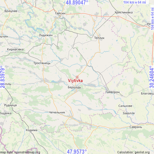
Viytivka GPS coordinates[2]
48° 25' 33.708" North, 29° 32' 34.476" East
| Map corner | latitude | longitude |
|---|---|---|
| Upper-left | 48.89047°, | 28.83979° |
| Center: | 48.42603°, | 29.54291° |
| Lower-right: | 47.9573°, | 30.24604° |
| Map W x H: | 103.8×103.8 km | = 64.5×64.5mi |
| max Lat: | 52.18903° ⇑46.8% North |
| Viytivka: | 48.42603° |
| min Lat: | ⇓53.2% South 44.39214° |
| min Long | Viytivka | max Long |
| 22.20555° | 29.54291° | 40.13222° |
| W 30%⇐ | ⇒70% E |
Elevation
Elevation of Viytivka is 185 m = 607 ft, and this is 29.2 m = 96 ft above average elevation for this country.
| Max E: |
886 m = 2907 ft | 35.1% |
| Viytivka | 185 m 607 ft | |
| Avg. | 155.8 m = 511 ft | |
Min E: |
-3 m = -10 ft | 64.9% |
See also: Ukraine elevation on elevation.city.
Geographical zone
Viytivka is located in North temperate zone (between Tropic of Cancer and the Arctic Circle). Distance of this North polar circle is 2016.7 km =1253.1 mi to North.| Distance of | km | miles | from Viytivka |
|---|---|---|---|
| North Pole | 4622.6 | 2872.3 | to North |
| Arctic Circle | 2016.7 | 1253.1 | to North |
| Tropic Cancer | 2778.6 | 1726.5 | to South |
| Equator | 5384.5 | 3345.8 | to South |


Nearby cities:
15 places around Viytivka: (largest is in red/bold)
• Bershad
6.7 km =4.2 mi,  196°
196°
• Blahovishchens’ke
51.6 km =32.1 mi,  101°
101°
• Chechelnyk
26.8 km =16.7 mi,  208°
208°
• Haisyn
44.3 km =27.5 mi,  345°
345°
• Hayvoron
25.9 km =16.1 mi,  111°
111°
• Kodyma
47.8 km =29.7 mi,  220°
220°
• Kryzhopil’
50.2 km =31.2 mi,  264°
264°
• Ladyzhyn
36.6 km =22.7 mi,  321°
321°
• Obodivka
21.9 km =13.6 mi, 263°
• Peschana
35.8 km =22.2 mi,  157°
157°
• Teplyk
30.5 km =19 mi,  29°
29°
• Torkanivka
31.3 km =19.4 mi,  248°
248°
• Trostyanets’
24.5 km =15.2 mi,  292°
292°
• Tsybulevka
32.8 km =20.4 mi, 262°
• Zavallya
42.2 km =26.2 mi,  124°
124°
Sources, notices
• [Note1] Compared only with cities in Ukraine existing in our database
• [Src1] Map data: © OpenStreetMap contributors (CC-BY-SA)
• [Src2] Other city data from geonames.org with taken over terms of usage.
• [Src3] Geographical zone / Annual Mean Temperature by Robert A. Rohde @ Wikipedia
