Bershad geodata
Bershad (Vinnyts'ka) is a seat of a second-order administrative division; located in Ukraine in Europe/Kiev (GMT+3) time zone. In our database, there are 1661 cities with bigger population. Compared to other cities in Ukraine, 51.9% of cities are located further ↓South; 70.4% of cities are located further →East and 60.8% of cities have lower elevation than Bershad. Note1


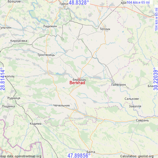
Bershad GPS coordinates[2]
48° 22' 4.152" North, 29° 31' 2.136" East
| Map corner | latitude | longitude |
|---|---|---|
| Upper-left | 48.8328°, | 28.81414° |
| Center: | 48.36782°, | 29.51726° |
| Lower-right: | 47.89856°, | 30.22039° |
| Map W x H: | 103.9×103.9 km | = 64.6×64.6mi |
| max Lat: | 52.18903° ⇑48.1% North |
| Bershad: | 48.36782° |
| min Lat: | ⇓51.9% South 44.39214° |
| min Long | Bershad | max Long |
| 22.20555° | 29.51726° | 40.13222° |
| W 29.6%⇐ | ⇒70.4% E |
Elevation
Elevation of Bershad is 171 m = 561 ft, and this is 15.2 m = 50 ft above average elevation for this country.
| Max E: |
886 m = 2907 ft | 39.2% |
| Bershad | 171 m 561 ft | |
| Avg. | 155.8 m = 511 ft | |
Min E: |
-3 m = -10 ft | 60.8% |
See also: Ukraine elevation on elevation.city.
Geographical zone
Bershad is located in North temperate zone (between Tropic of Cancer and the Arctic Circle). Distance of this North polar circle is 2023.2 km =1257.2 mi to North.| Distance of | km | miles | from Bershad |
|---|---|---|---|
| North Pole | 4629.1 | 2876.4 | to North |
| Arctic Circle | 2023.2 | 1257.2 | to North |
| Tropic Cancer | 2772.1 | 1722.5 | to South |
| Equator | 5378 | 3341.7 | to South |


Nearby cities:
15 places around Bershad: (largest is in red/bold)
• Balta
48.7 km =30.3 mi,  171°
171°
• Chechelnyk
20.3 km =12.6 mi,  213°
213°
• Hayvoron
26.1 km =16.2 mi,  96°
96°
• Kodyma
41.7 km =25.9 mi,  224°
224°
• Kryzhopil’
48.1 km =29.9 mi,  271°
271°
• Ladyzhyn
40.9 km =25.4 mi,  329°
329°
• Obodivka
20.3 km =12.6 mi,  281°
281°
• Peschana
30.9 km =19.2 mi,  149°
149°
• Savran
49.4 km =30.7 mi,  122°
122°
• Teplyk
37.1 km =23.1 mi,  26°
26°
• Torkanivka
27.7 km =17.2 mi,  260°
260°
• Trostyanets’
26.1 km =16.2 mi,  307°
307°
• Tsybulevka
30.7 km =19.1 mi, 274°
• Viytivka
6.7 km =4.2 mi,  16°
16°
• Zavallya
40.7 km =25.3 mi,  114°
114°
Sources, notices
• [Note1] Compared only with cities in Ukraine existing in our database
• [Src1] Map data: © OpenStreetMap contributors (CC-BY-SA)
• [Src2] Other city data from geonames.org with taken over terms of usage.
• [Src3] Geographical zone / Annual Mean Temperature by Robert A. Rohde @ Wikipedia
