Lobachiv geodata
Lobachiv (Kyiv) is a populated place; located in Ukraine in Europe/Kiev (GMT+3) time zone. With population of 896 people, there are 1435 cities with bigger population in this country. Compared to other cities in Ukraine, 73.4% of cities are located further ↓South; 68.4% of cities are located further →East and 64.3% of cities have lower elevation than Lobachiv. Note1


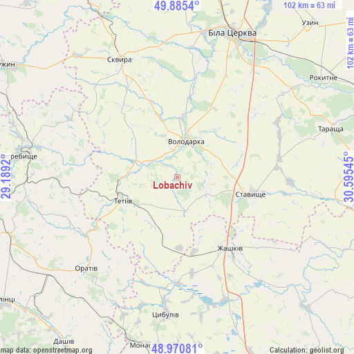
Lobachiv GPS coordinates[2]
49° 25' 48.864" North, 29° 53' 32.352" East
| Map corner | latitude | longitude |
|---|---|---|
| Upper-left | 49.8854°, | 29.1892° |
| Center: | 49.43024°, | 29.89232° |
| Lower-right: | 48.97081°, | 30.59545° |
| Map W x H: | 101.7×101.7 km | = 63.2×63.2mi |
| max Lat: | 52.18903° ⇑26.6% North |
| Lobachiv: | 49.43024° |
| min Lat: | ⇓73.4% South 44.39214° |
| min Long | Lobachiv | max Long |
| 22.20555° | 29.89232° | 40.13222° |
| W 31.6%⇐ | ⇒68.4% E |
Elevation
Elevation of Lobachiv is 183 m = 600 ft, and this is 27.2 m = 89 ft above average elevation for this country.
| Max E: |
886 m = 2907 ft | 35.7% |
| Lobachiv | 183 m 600 ft | |
| Avg. | 155.8 m = 511 ft | |
Min E: |
-3 m = -10 ft | 64.3% |
See also: Ukraine elevation on elevation.city.
Geographical zone
Lobachiv is located in North temperate zone (between Tropic of Cancer and the Arctic Circle). Distance of this North polar circle is 1905 km =1183.7 mi to North.| Distance of | km | miles | from Lobachiv |
|---|---|---|---|
| North Pole | 4510.9 | 2802.9 | to North |
| Arctic Circle | 1905 | 1183.7 | to North |
| Tropic Cancer | 2890.2 | 1795.9 | to South |
| Equator | 5496.1 | 3415.1 | to South |


Nearby cities:
15 places around Lobachiv: (largest is in red/bold)
• Bila Tserkva
45 km =28 mi,  20°
20°
• Buky
49 km =30.4 mi,  338°
338°
• Kalynove
40.8 km =25.4 mi,  97°
97°
• Monastyryshche
49.3 km =30.6 mi,  187°
187°
• Orativ
37.7 km =23.4 mi,  224°
224°
• Pohrebyshche
45.9 km =28.5 mi,  277°
277°
• Roskoshnyy
22.2 km =13.8 mi,  107°
107°
• Skvyra
37.3 km =23.2 mi,  334°
334°
• Stavyshche
22 km =13.7 mi, 101°
• Tarashcha
45.6 km =28.3 mi,  71°
71°
• Tetiiv
17.5 km =10.9 mi,  250°
250°
• Topory
48.2 km =30 mi,  300°
300°
• Tsibulev
39.2 km =24.4 mi,  184°
184°
• Volodarka
10.6 km =6.6 mi,  7°
7°
• Zhashkiv
25.9 km =16.1 mi,  142°
142°
Sources, notices
• [Note1] Compared only with cities in Ukraine existing in our database
• [Src1] Map data: © OpenStreetMap contributors (CC-BY-SA)
• [Src2] Other city data from geonames.org with taken over terms of usage.
• [Src3] Geographical zone / Annual Mean Temperature by Robert A. Rohde @ Wikipedia
