Kotido geodata
Kotido (Northern Region) is a seat of a second-order administrative division; located in Uganda in Africa/Kampala (GMT+3) time zone. With population of 18,800 people, there are 38 cities with bigger population in this country. Compared to other cities in Uganda, 93.2% of cities are located further ↓South; 89.7% of cities are located further ←West and 61% of cities have lower elevation than Kotido. Note1
Administrative division(s):
- Level 1: Northern Region
- Level 2: Kotido District
- Level 3: Jie County
- Level 4: Panyangara


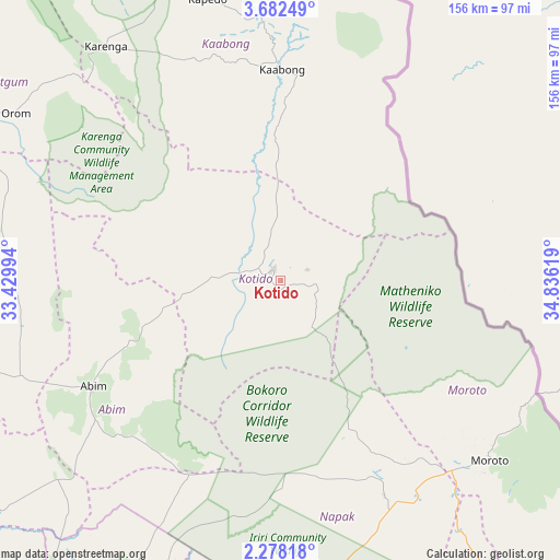
Kotido GPS coordinates[2]
2° 58' 50.016" North, 34° 7' 59.016" East
| Map corner | latitude | longitude |
|---|---|---|
| Upper-left | 3.68249°, | 33.42994° |
| Center: | 2.98056°, | 34.13306° |
| Lower-right: | 2.27818°, | 34.83619° |
| Map W x H: | 156.1×156.1 km | = 97×97mi |
| max Lat: | 3.66088° ⇑6.8% North |
| Kotido: | 2.98056° |
| min Lat: | ⇓93.2% South -1.28538° |
| min Long | Kotido | max Long |
| 29.65° | 34.13306° | 34.95° |
| W 89.7%⇐ | ⇒10.3% E |
Elevation
Elevation of Kotido is 1227 m = 4026 ft, and this is 32 m = 105 ft below average elevation for this country.
| Max E: |
4129 m = 13547 ft | 39% |
| Avg. | 1259 m = 4131 ft | |
| Kotido | 1227 m = 4026 ft | |
Min E: |
622 m = 2041 ft | 61% |
See also: Uganda elevation on elevation.city.
Geographical zone
Kotido is located in North Torrid zone (between Equator and Tropic of Cancer). Distance of Equator is 331.4 km =205.9 mi to South.| Distance of | km | miles | from Kotido |
|---|---|---|---|
| North Pole | 9675.7 | 6012.2 | to North |
| Arctic Circle | 7069.8 | 4393 | to North |
| Tropic Cancer | 2274.5 | 1413.3 | to North |
| Equator | 331.4 | 205.9 | to South |


Nearby cities:
15 places around Kotido: (largest is in red/bold)
• Abim
59.5 km =37 mi,  238°
238°
• Agago
90.3 km =56.1 mi,  259°
259°
• Alebtong
127.3 km =79.1 mi,  230°
230°
• Amudat
146.2 km =90.8 mi,  141°
141°
• Amuria
121.1 km =75.2 mi,  206°
206°
• Kaabong
56 km =34.8 mi,  1°
1°
• Katakwi
122.5 km =76.1 mi,  188°
188°
• Kitgum
142.3 km =88.4 mi,  283°
283°
• Moroto
77.3 km =48 mi,  129°
129°
• Nakapiripirit
138.6 km =86.1 mi,  148°
148°
• Napak
82.1 km =51 mi,  170°
170°
• Otuke
88.2 km =54.8 mi, 232°
• Pader
102 km =63.4 mi,  274°
274°
• Pader Palwo
112.6 km =70 mi, 259°
• Soroti
152.2 km =94.6 mi,  202°
202°
Sources, notices
• [Note1] Compared only with cities in Uganda existing in our database
• [Src1] Map data: © OpenStreetMap contributors (CC-BY-SA)
• [Src2] Other city data from geonames.org with taken over terms of usage.
• [Src3] Geographical zone / Annual Mean Temperature by Robert A. Rohde @ Wikipedia
