Velázquez geodata
Velázquez (Rocha) is a populated place; located in Uruguay in America/Montevideo (GMT-3) time zone. With population of 1,090 people, there are 117 cities with bigger population in this country. Compared to other cities in Uruguay, 50% of cities are located further ↓South; 91% of cities are located further ←West and 60.7% of cities have lower elevation than Velázquez. Note1


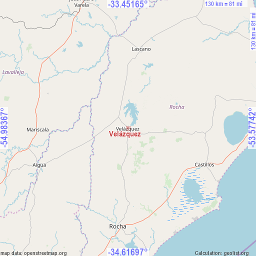
Velázquez GPS coordinates[2]
34° 2' 10.716" South, 54° 16' 49.944" West
| Map corner | latitude | longitude |
|---|---|---|
| Upper-left | -33.45165°, | -54.98367° |
| Center: | -34.03631°, | -54.28054° |
| Lower-right: | -34.61697°, | -53.57742° |
| Map W x H: | 129.6×129.6 km | = 80.5×80.5mi |
| max Lat: | -30.25966° ⇑50% North |
| Velázquez: | -34.03631° |
| min Lat: | ⇓50% South -34.94747° |
| min Long | Velázquez | max Long |
| -58.41176° | -54.28054° | -53.38583° |
| W 91%⇐ | ⇒9% E |
Elevation
Elevation of Velázquez is 66 m = 217 ft, and this is 4.6 m = 15 ft below average elevation for this country.
| Max E: |
294 m = 965 ft | 39.3% |
| Avg. | 70.6 m = 232 ft | |
| Velázquez | 66 m = 217 ft | |
Min E: |
2 m = 7 ft | 60.7% |
See also: Uruguay elevation on elevation.city.
Geographical zone
Velázquez is located in South temperate zone (between Tropic of Capricorn and the Antarctic Circle). Distance of this Southern Tropic circle is 1178.6 km =732.3 mi to North.| Distance of | km | miles | from Velázquez |
|---|---|---|---|
| Equator | 3784.5 | 2351.6 | to North |
| Tropic Capricorn | 1178.6 | 732.3 | to North |
| Antarctic Circle | 3616.7 | 2247.3 | to South |
| South Pole | 6222.6 | 3866.5 | to South |


Nearby cities:
15 places around Velázquez: (largest is in red/bold)
• Aiguá
47.7 km =29.6 mi,  246°
246°
• Castillos
42.8 km =26.6 mi,  114°
114°
• Cebollatí
96.7 km =60.1 mi,  27°
27°
• Chui
84.6 km =52.6 mi,  63°
63°
• Dieciocho de Julio
77.8 km =48.3 mi, 59°
• José Batlle y Ordóñez
99.9 km =62.1 mi,  309°
309°
• José Pedro Varela
68.9 km =42.8 mi,  339°
339°
• La Paloma
70.5 km =43.8 mi,  171°
171°
• Lascano
41 km =25.5 mi,  9°
9°
• Mariscala
45.8 km =28.5 mi,  269°
269°
• Minas
95.8 km =59.5 mi, 246°
• Rocha
49.9 km =31 mi,  185°
185°
• San Carlos
102.3 km =63.6 mi,  214°
214°
• Treinta y Tres
89.8 km =55.8 mi,  353°
353°
• Villa Sara
88 km =54.7 mi, 351°
Sources, notices
• [Note1] Compared only with cities in Uruguay existing in our database
• [Src1] Map data: © OpenStreetMap contributors (CC-BY-SA)
• [Src2] Other city data from geonames.org with taken over terms of usage.
• [Src3] Geographical zone / Annual Mean Temperature by Robert A. Rohde @ Wikipedia
