Postmasburg geodata
Postmasburg (Northern Cape) is a seat of a third-order administrative division; located in South Africa in Africa/Johannesburg (GMT+2) time zone. With population of 30,089 people, there are 123 cities with bigger population in this country. Compared to other cities in South Africa, 52.8% of cities are located further ↓South; 81.4% of cities are located further →East and 64% of cities have lower elevation than Postmasburg. Note1
Administrative division(s):
- Level 1: Northern Cape
- Level 2: Siyanda District Municipality
- Level 3: Tsantsabane


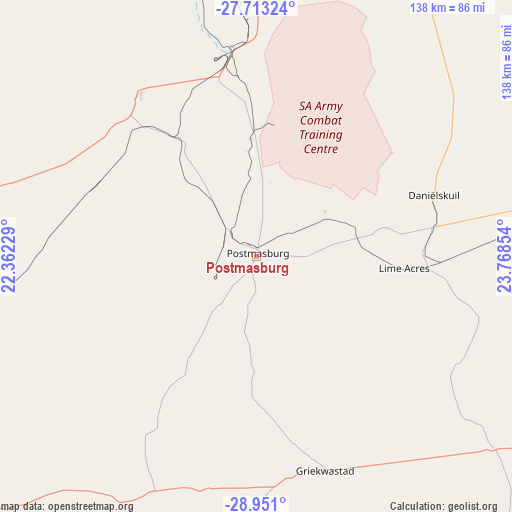
Postmasburg GPS coordinates[2]
28° 20' 2.112" South, 23° 3' 55.476" East
| Map corner | latitude | longitude |
|---|---|---|
| Upper-left | -27.71324°, | 22.36229° |
| Center: | -28.33392°, | 23.06541° |
| Lower-right: | -28.951°, | 23.76854° |
| Map W x H: | 137.6×137.6 km | = 85.5×85.5mi |
| max Lat: | -22.34881° ⇑47.2% North |
| Postmasburg: | -28.33392° |
| min Lat: | ⇓52.8% South -34.66739° |
| min Long | Postmasburg | max Long |
| 16.8697° | 23.06541° | 32.26762° |
| W 18.6%⇐ | ⇒81.4% E |
Elevation
Elevation of Postmasburg is 1305 m = 4281 ft, and this is 335.4 m = 1100 ft above average elevation for this country.
| Max E: |
1873 m = 6145 ft | 36% |
| Postmasburg | 1305 m 4281 ft | |
| Avg. | 969.6 m = 3181 ft | |
Min E: |
7 m = 23 ft | 64% |
See also: South Africa elevation on elevation.city.
Geographical zone
Postmasburg is located in South temperate zone (between Tropic of Capricorn and the Antarctic Circle). Distance of this Southern Tropic circle is 544.5 km =338.3 mi to North.| Distance of | km | miles | from Postmasburg |
|---|---|---|---|
| Equator | 3150.4 | 1957.6 | to North |
| Tropic Capricorn | 544.5 | 338.3 | to North |
| Antarctic Circle | 4250.7 | 2641.3 | to South |
| South Pole | 6856.6 | 4260.5 | to South |


Nearby cities:
15 places around Postmasburg: (largest is in red/bold)
• Barkly West
144.1 km =89.5 mi,  98°
98°
• Daniëlskuil
49.2 km =30.6 mi,  70°
70°
• Douglas
105.9 km =65.8 mi,  139°
139°
• Groblershoop
122.6 km =76.2 mi,  239°
239°
• Hartswater
181.9 km =113 mi, 69°
• Hopetown
174.5 km =108.4 mi,  145°
145°
• Jan Kempdorp
179 km =111.2 mi,  75°
75°
• Kathu
71 km =44.1 mi,  358°
358°
• Kimberley
171.6 km =106.6 mi, 104°
• Kuruman
104.4 km =64.9 mi,  20°
20°
• Pampierstad
170.5 km =105.9 mi, 68°
• Prieska
151.6 km =94.2 mi,  191°
191°
• Ritchie
169.2 km =105.1 mi,  117°
117°
• Upington
177.4 km =110.2 mi,  265°
265°
• Warrenton
176.3 km =109.5 mi, 82°
Sources, notices
• [Note1] Compared only with cities in South Africa existing in our database
• [Src1] Map data: © OpenStreetMap contributors (CC-BY-SA)
• [Src2] Other city data from geonames.org with taken over terms of usage.
• [Src3] Geographical zone / Annual Mean Temperature by Robert A. Rohde @ Wikipedia
