Groblershoop geodata
Groblershoop (Northern Cape) is a seat of a third-order administrative division; located in South Africa in Africa/Johannesburg (GMT+2) time zone. In our database, there are 257 cities with bigger population. Compared to other cities in South Africa, 54.6% of cities are located further ↑North; 84.7% of cities are located further →East and 63.1% of cities have higher elevation than Groblershoop. Note1
Administrative division(s):
- Level 1: Northern Cape
- Level 2: Siyanda District Municipality
- Level 3: !Kheis


Groblershoop GPS coordinates[2]
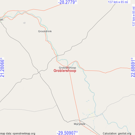
28° 53' 43.116" South, 21° 59' 1.608" East
| Map corner | latitude | longitude |
|---|---|---|
| Upper-left | -28.2779°, | 21.28066° |
| Center: | -28.89531°, | 21.98378° |
| Lower-right: | -29.50907°, | 22.68691° |
| Map W x H: | 136.9×136.9 km | = 85.1×85.1mi |
| max Lat: | -22.34881° ⇑54.6% North |
| Groblershoop: | -28.89531° |
| min Lat: | ⇓45.4% South -34.66739° |
| min Long | Groblershoop | max Long |
| 16.8697° | 21.98378° | 32.26762° |
| W 15.3%⇐ | ⇒84.7% E |
Elevation
Elevation of Groblershoop is 868 m = 2848 ft, and this is 101.6 m = 333 ft below average elevation for this country.
| Max E: |
1873 m = 6145 ft | 63.1% |
| Avg. | 969.6 m = 3181 ft | |
| Groblershoop | 868 m = 2848 ft | |
Min E: |
7 m = 23 ft | 36.9% |
See also: South Africa elevation on elevation.city.
Geographical zone
Groblershoop is located in South temperate zone (between Tropic of Capricorn and the Antarctic Circle). Distance of this Southern Tropic circle is 606.9 km =377.1 mi to North.| Distance of | km | miles | from Groblershoop |
|---|---|---|---|
| Equator | 3212.9 | 1996.4 | to North |
| Tropic Capricorn | 606.9 | 377.1 | to North |
| Antarctic Circle | 4188.3 | 2602.5 | to South |
| South Pole | 6794.2 | 4221.7 | to South |


Nearby cities:
15 places around Groblershoop: (largest is in red/bold)
• Barkly West
250.7 km =155.8 mi,  80°
80°
• Brandvlei
226.7 km =140.9 mi,  219°
219°
• Carnarvon
230.9 km =143.5 mi,  176°
176°
• Daniëlskuil
171.1 km =106.3 mi,  62°
62°
• Douglas
175.1 km =108.8 mi,  95°
95°
• Hopetown
219.4 km =136.3 mi,  111°
111°
• Kakamas
134 km =83.3 mi,  275°
275°
• Kathu
169.3 km =105.2 mi,  38°
38°
• Kenhardt
94.6 km =58.8 mi,  238°
238°
• Kuruman
214.2 km =133.1 mi, 41°
• Pofadder
253.1 km =157.3 mi,  264°
264°
• Postmasburg
122.6 km =76.2 mi, 59°
• Prieska
113.1 km =70.3 mi,  139°
139°
• Upington
86.7 km =53.9 mi,  305°
305°
• Van Wyksvlei
162.6 km =101 mi,  185°
185°
Sources, notices
• [Note1] Compared only with cities in South Africa existing in our database
• [Src1] Map data: © OpenStreetMap contributors (CC-BY-SA)
• [Src2] Other city data from geonames.org with taken over terms of usage.
• [Src3] Geographical zone / Annual Mean Temperature by Robert A. Rohde @ Wikipedia
