Zvishavane geodata
Zvishavane (Masvingo) is a populated place; located in Zimbabwe in Africa/Harare (GMT+2) time zone. With population of 35,896 people, there are 14 cities with bigger population in this country. Compared to other cities in Zimbabwe, 92.3% of cities are located further ↑North; 61.5% of cities are located further →East and 81.5% of cities have higher elevation than Zvishavane. Note1


Zvishavane GPS coordinates[2]
20° 19' 36.264" South, 30° 3' 59.328" East
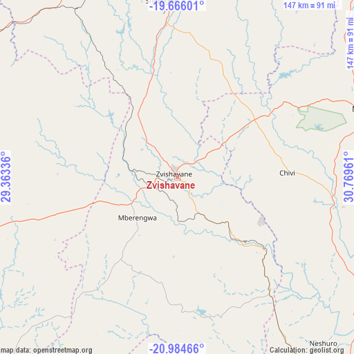
| Map corner | latitude | longitude |
|---|---|---|
| Upper-left | -19.66601°, | 29.36336° |
| Center: | -20.32674°, | 30.06648° |
| Lower-right: | -20.98466°, | 30.76961° |
| Map W x H: | 146.6×146.6 km | = 91.1×91.1mi |
| max Lat: | -16.03333° ⇑92.3% North |
| Zvishavane: | -20.32674° |
| min Lat: | ⇓7.7% South -22.21667° |
| min Long | Zvishavane | max Long |
| 25.83066° | 30.06648° | 32.86667° |
| W 38.5%⇐ | ⇒61.5% E |
Elevation
Elevation of Zvishavane is 998 m = 3274 ft, and this is 199.7 m = 655 ft below average elevation for this country.
| Max E: |
1706 m = 5597 ft | 81.5% |
| Avg. | 1197.7 m = 3929 ft | |
| Zvishavane | 998 m = 3274 ft | |
Min E: |
402 m = 1319 ft | 18.5% |
See also: Zimbabwe elevation on elevation.city.
Geographical zone
Zvishavane is located in South Torrid zone (between Equator and Tropic of Capricorn). Distance of this Southern Tropic circle is 345.8 km =214.9 mi to South.| Distance of | km | miles | from Zvishavane |
|---|---|---|---|
| Equator | 2260.1 | 1404.4 | to North |
| Tropic Capricorn | 345.8 | 214.9 | to South |
| Antarctic Circle | 5141.1 | 3194.5 | to South |
| South Pole | 7746.9 | 4813.7 | to South |


Nearby cities:
15 places around Zvishavane: (largest is in red/bold)
• Bulawayo
156 km =96.9 mi,  277°
277°
• Esigodini
119.4 km =74.2 mi,  271°
271°
• Filabusi
84.6 km =52.6 mi,  254°
254°
• Gwanda
129.4 km =80.4 mi,  238°
238°
• Gweru
100.9 km =62.7 mi,  345°
345°
• Insiza
108.8 km =67.6 mi,  303°
303°
• Inyati
146.6 km =91.1 mi, 299°
• Kwekwe
157.7 km =98 mi, 350°
• Lalapanzi
111.2 km =69.1 mi,  6°
6°
• Mashava
54.1 km =33.6 mi,  53°
53°
• Masvingo
84.6 km =52.6 mi,  69°
69°
• Mvuma
126.1 km =78.4 mi,  22°
22°
• Redcliff
146.8 km =91.2 mi, 348°
• Shangani
94.8 km =58.9 mi,  309°
309°
• Shurugwi
73.3 km =45.5 mi,  355°
355°
Sources, notices
• [Note1] Compared only with cities in Zimbabwe existing in our database
• [Src1] Map data: © OpenStreetMap contributors (CC-BY-SA)
• [Src2] Other city data from geonames.org with taken over terms of usage.
• [Src3] Geographical zone / Annual Mean Temperature by Robert A. Rohde @ Wikipedia
