Mvuma geodata
Mvuma (Midlands) is a populated place; located in Zimbabwe in Africa/Harare (GMT+2) time zone. With population of 4,331 people, there are 44 cities with bigger population in this country. Compared to other cities in Zimbabwe, 72.3% of cities are located further ↑North; 50.8% of cities are located further ←West and 75.4% of cities have lower elevation than Mvuma. Note1


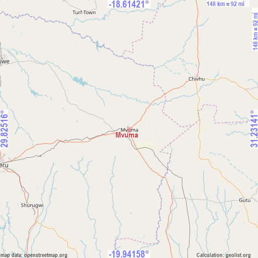
Mvuma GPS coordinates[2]
19° 16' 45.264" South, 30° 31' 41.808" East
| Map corner | latitude | longitude |
|---|---|---|
| Upper-left | -18.61421°, | 29.82516° |
| Center: | -19.27924°, | 30.52828° |
| Lower-right: | -19.94158°, | 31.23141° |
| Map W x H: | 147.6×147.6 km | = 91.7×91.7mi |
| max Lat: | -16.03333° ⇑72.3% North |
| Mvuma: | -19.27924° |
| min Lat: | ⇓27.7% South -22.21667° |
| min Long | Mvuma | max Long |
| 25.83066° | 30.52828° | 32.86667° |
| W 50.8%⇐ | ⇒49.2% E |
Elevation
Elevation of Mvuma is 1387 m = 4551 ft, and this is 189.3 m = 621 ft above average elevation for this country.
| Max E: |
1706 m = 5597 ft | 24.6% |
| Mvuma | 1387 m 4551 ft | |
| Avg. | 1197.7 m = 3929 ft | |
Min E: |
402 m = 1319 ft | 75.4% |
See also: Zimbabwe elevation on elevation.city.
Geographical zone
Mvuma is located in South Torrid zone (between Equator and Tropic of Capricorn). Distance of this Southern Tropic circle is 462.3 km =287.3 mi to South.| Distance of | km | miles | from Mvuma |
|---|---|---|---|
| Equator | 2143.7 | 1332 | to North |
| Tropic Capricorn | 462.3 | 287.3 | to South |
| Antarctic Circle | 5257.5 | 3266.9 | to South |
| South Pole | 7863.4 | 4886.1 | to South |


Nearby cities:
15 places around Mvuma: (largest is in red/bold)
• Beatrice
119 km =73.9 mi,  16°
16°
• Chegutu
134.1 km =83.3 mi,  342°
342°
• Chivhu
47.8 km =29.7 mi,  53°
53°
• Dorowa Mining Lease
130.5 km =81.1 mi,  79°
79°
• Gweru
77 km =47.8 mi,  255°
255°
• Insiza
150.1 km =93.3 mi,  248°
248°
• Kadoma
123.4 km =76.7 mi,  328°
328°
• Kwekwe
84.5 km =52.5 mi,  297°
297°
• Lalapanzi
37.3 km =23.2 mi, 260°
• Mashava
84.4 km =52.4 mi,  183°
183°
• Masvingo
92.7 km =57.6 mi,  160°
160°
• Redcliff
82.9 km =51.5 mi,  289°
289°
• Shangani
134 km =83.3 mi, 245°
• Shurugwi
69.9 km =43.4 mi,  231°
231°
• Zvishavane
126.1 km =78.4 mi,  202°
202°
Sources, notices
• [Note1] Compared only with cities in Zimbabwe existing in our database
• [Src1] Map data: © OpenStreetMap contributors (CC-BY-SA)
• [Src2] Other city data from geonames.org with taken over terms of usage.
• [Src3] Geographical zone / Annual Mean Temperature by Robert A. Rohde @ Wikipedia
